
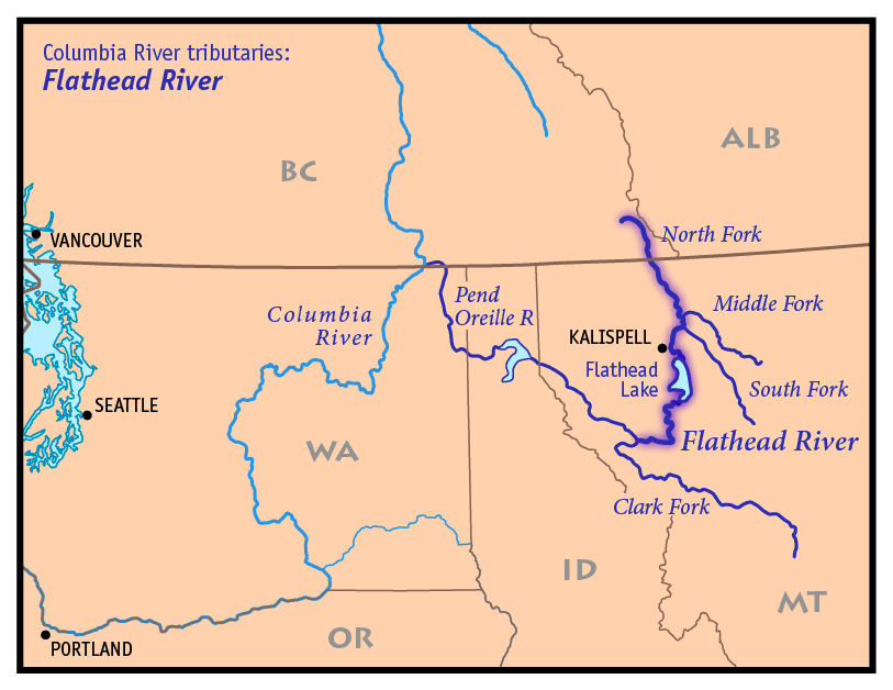
Image: Flathead River Map
Size of this preview: 776 × 599 pixels. Other resolutions: 311 × 240 pixels | 813 × 628 pixels.
Original image (813 × 628 pixels, file size: 100 KB, MIME type: image/png)
Description: This is a map of the Flathead River —in the Western United States and Canada. Credits I, Pfly, created it based on USGS and Digital Chart of the World data.
Title: Flathead River Map
Credit: Own work
Author: Pfly
Usage Terms: Creative Commons Attribution-Share Alike 3.0
License: CC-BY-SA-3.0
License Link: http://creativecommons.org/licenses/by-sa/3.0/
Attribution Required?: Yes
Image usage
The following 4 pages link to this image:

All content from Kiddle encyclopedia articles (including the article images and facts) can be freely used under Attribution-ShareAlike license, unless stated otherwise.