
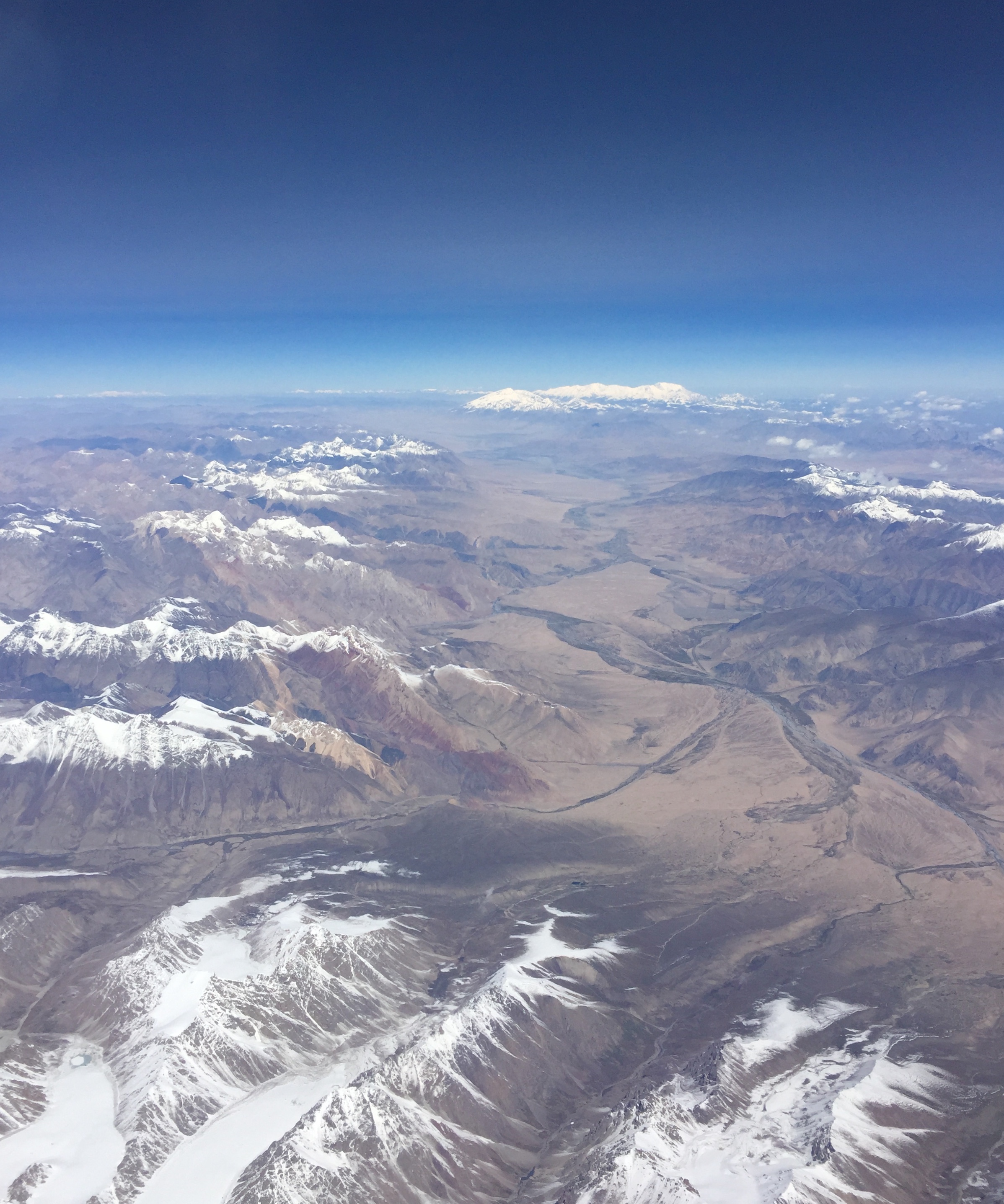
Image: Fly over Pamir Mountains and Karakoram Highway
Size of this preview: 500 × 600 pixels. Other resolutions: 200 × 240 pixels | 2,396 × 2,875 pixels.
Original image (2,396 × 2,875 pixels, file size: 1.67 MB, MIME type: image/jpeg)
Description: Pamir Mountains and Karakoram Highway in the valley. Mt Muztagh Ata is seen at the far center.
Title: Fly over Pamir Mountains and Karakoram Highway
Credit: Own work
Author: Xuan Che
Usage Terms: Creative Commons Attribution-Share Alike 4.0
License: CC BY-SA 4.0
License Link: https://creativecommons.org/licenses/by-sa/4.0
Attribution Required?: Yes
Image usage
The following page links to this image:

All content from Kiddle encyclopedia articles (including the article images and facts) can be freely used under Attribution-ShareAlike license, unless stated otherwise.