
Image: FortHarmar
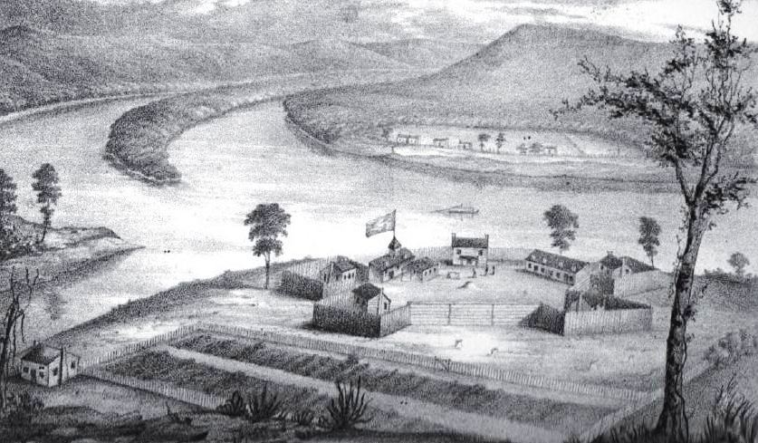
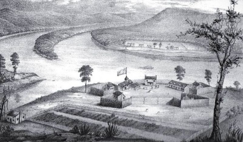
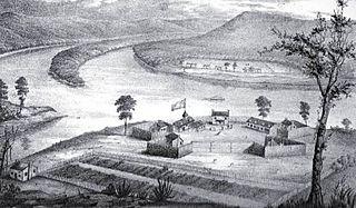
Description: Fort Harmar, constructed in the autumn of 1785 at the confluence of the Ohio and Muskingum rivers, on the west side of the mouth of the Muskingum River. “The position was judiciously chosen, as it commanded not only the mouth of the Muskingum, but swept the waters of the Ohio, from a curve in the river for a considerable distance both above and below the fort.” The view of the image is looking forward towards the Ohio, with the mouth of the Muskingum on the left; in the background, across the Ohio River, are houses of the settlement that would later become Williamstown. Buckley Island is located to the upper left in the Ohio River. The Campus Martius fortification of the Marietta settlement was built on the east side of the Muskingum and upriver from Fort Harmar during 1788, and fully completed in 1791 at the start of the Northwest Indian War. The Picketed Point fortification of Marietta was built directly across the Muskingum from Fort Harmar, on the east side of the mouth, during 1791. Image and quote from the book by S. P. Hildreth: Pioneer History: Being an Account of the First Examinations of the Ohio Valley, and the Early Settlement of the Northwest Territory, H. W. Derby and Co., Cincinnati, Ohio (1848). Illustration plate located between pp. 316-17. ColWilliam (talk) 20:54, 11 April 2008 (UTC)
Title: FortHarmar
Credit: Hildreth, S. P. (1848) Pioneer History: Being an Account of the First Examinations of the Ohio Valley, and the Early Settlement of the Northwest Territory, Cincinnati: H. W. Derby and Co, p. 316 1/2
Author: Judge Joseph Gilman (1738-1806)
Usage Terms: Public domain
License: Public domain
Attribution Required?: No
Image usage
The following 3 pages link to this image:
