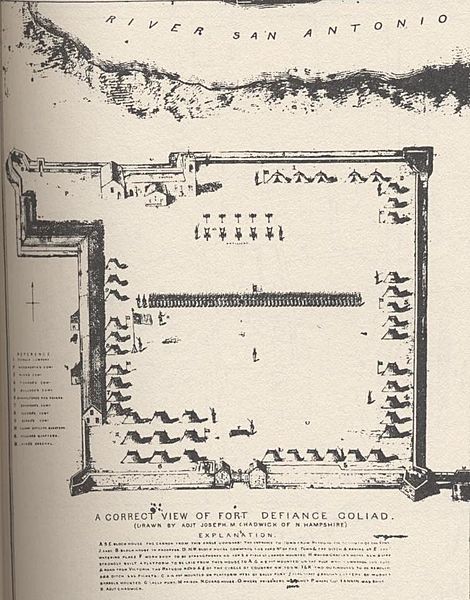
Image: Fort Independence (Goliad) 1836

Size of this preview: 470 × 600 pixels. Other resolutions: 188 × 240 pixels | 758 × 967 pixels.
Original image (758 × 967 pixels, file size: 121 KB, MIME type: image/jpeg)
Description: This is a diagram of Fort Defiance (also known as Presidio La Bahia) in Goliad, Texas. The tents mark the location where various companies camped within the fort. Chadwick was the Adjutant under Colonel James Fannin in 1836, and died with Fannin in 1836. The map was reprinted by the US federal government in 1856, with the locations of Fannin's and Chadwick's executions marked.
Title: Fort Independence (Goliad) 1836
Credit: reprinted in Hobart Huson's 1974 book Captain Phillip Dimmitt's Commandancy of Goliad
Author: Joseph M. Chadwick
Usage Terms: Public domain
License: Public domain
Attribution Required?: No
Image usage
The following 4 pages link to this image:

All content from Kiddle encyclopedia articles (including the article images and facts) can be freely used under Attribution-ShareAlike license, unless stated otherwise.
