
Image: Fort King George Switzermap
Size of this preview: 398 × 599 pixels. Other resolutions: 159 × 240 pixels | 795 × 1,196 pixels.
Original image (795 × 1,196 pixels, file size: 357 KB, MIME type: image/jpeg)
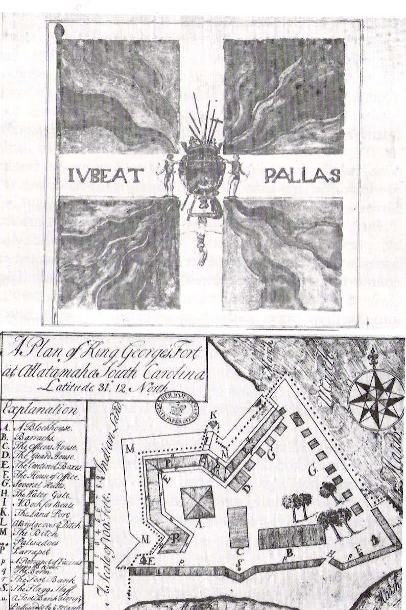
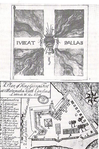
Description: A Plan of Fort King George's Fort at Allatamaha, South Carolina Latitude 31 degrees 12" North, 1722. This file is public domain since it was created in 1722.
Title: Fort King George Switzermap
Credit: Georgia Department of Archives and History
Author: Unknown authorUnknown author
Permission: Public Domain
Usage Terms: Public domain
License: Public domain
Attribution Required?: No
Image usage
The following page links to this image:

All content from Kiddle encyclopedia articles (including the article images and facts) can be freely used under Attribution-ShareAlike license, unless stated otherwise.