
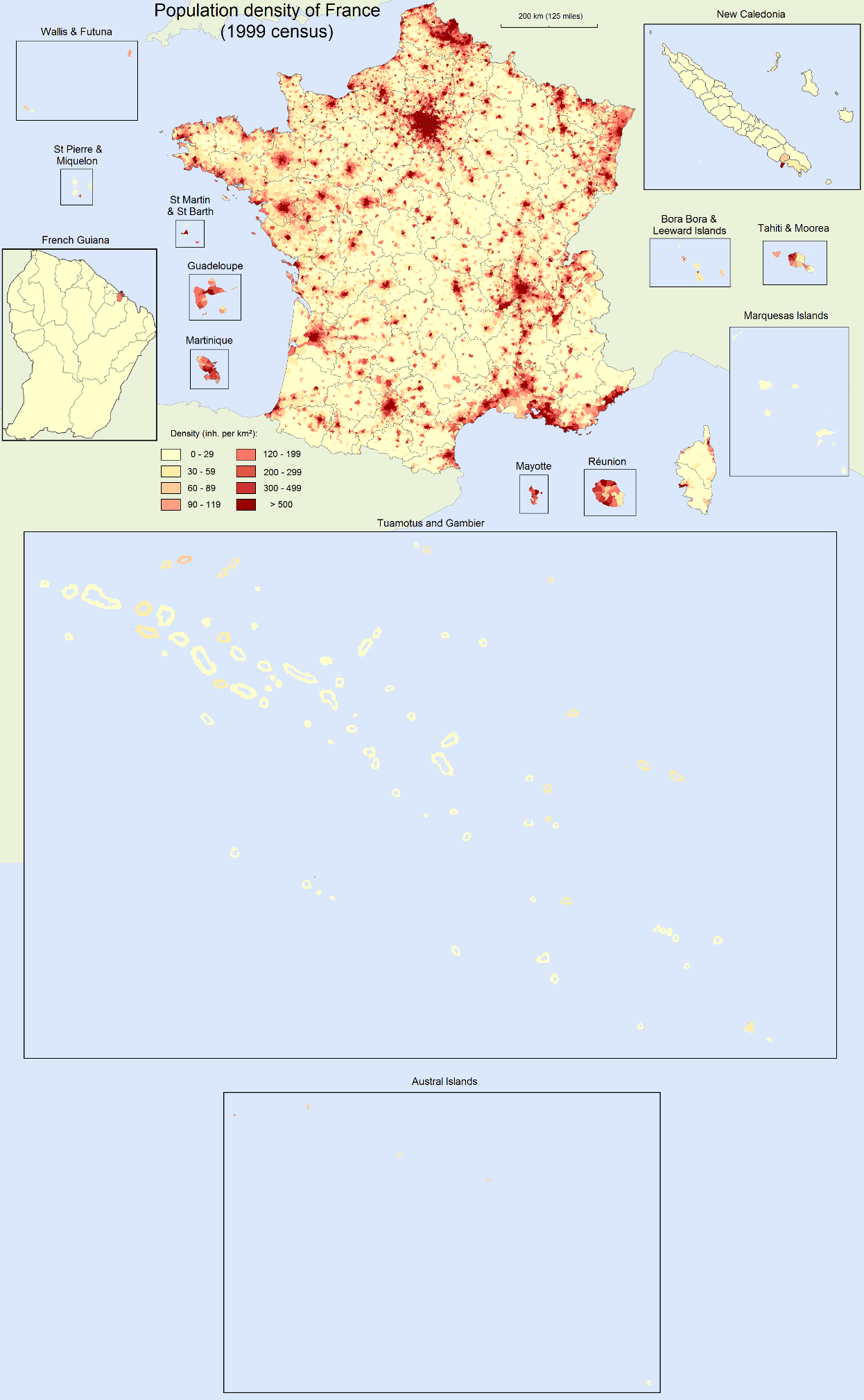
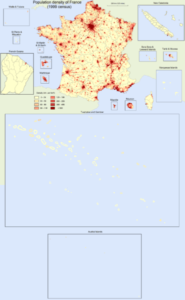
Image: France population density 40pc
Description: Population density map of France (40% of original). For the original (more detailed) version of the map, see: France_population_density.png. Density is as of 1999 census for Metropolitan France, Réunion, French Guiana, Martinique, Guadeloupe, St Martin & St Barth, and St Pierre & Miquelon. Density is as of 2002 census for Mayotte, Tahiti & Moorea, Bora Bora & Leeward Islands, Marquesas Islands, Tuamotus & Gambier, and Austral Islands. Density is as of 2003 census for Wallis & Futuna. Density is as of 2004 census for New Caledonia.
Title: France population density 40pc
Credit: Own work
Author: Der Statistiker
Usage Terms: Creative Commons Attribution-Share Alike 3.0
License: CC BY-SA 3.0
License Link: http://creativecommons.org/licenses/by-sa/3.0
Attribution Required?: Yes
Image usage
There are no pages that link to this image.
