
Image: Franklingulfstream
Size of this preview: 736 × 599 pixels. Other resolutions: 295 × 240 pixels | 3,089 × 2,515 pixels.
Original image (3,089 × 2,515 pixels, file size: 1.2 MB, MIME type: image/jpeg)
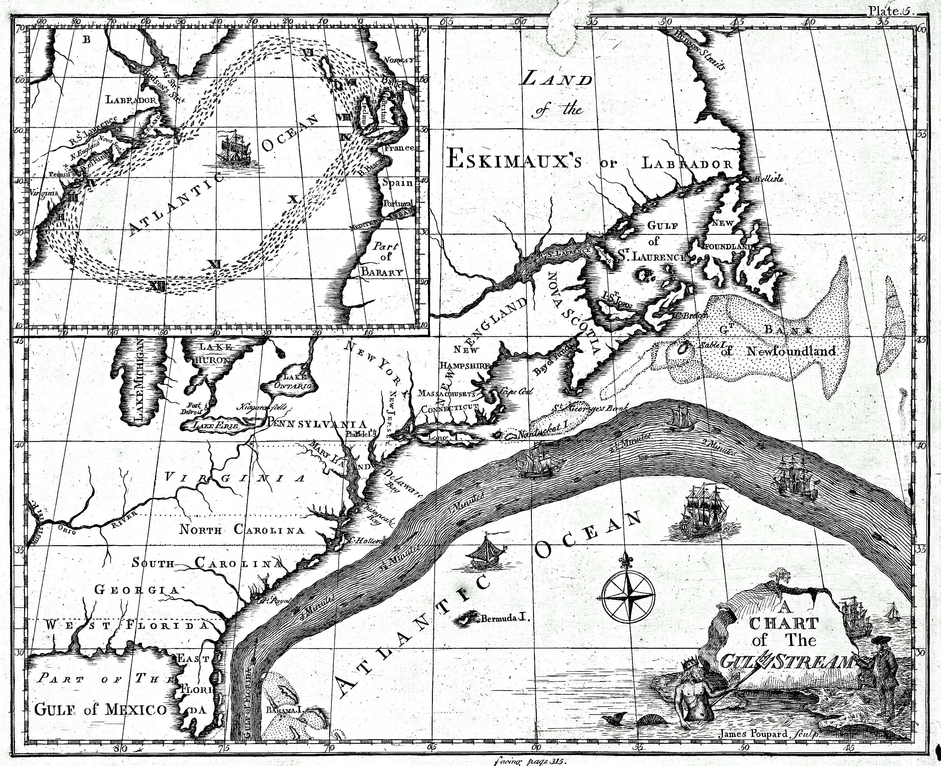
Description: Earliest known map of the Gulf Stream
Title: Franklingulfstream
Credit: http://oceanexplorer.noaa.gov/library/readings/hires/gulf_stream_map.jpg (stale) Available from Library of Congress: https://www.loc.gov/item/2004627238/ Archive thereof: https://web.archive.org/web/20151105175217/http://www.loc.gov/item/2004627238/
Author: Library of Congress/Benjamin Franklin
Usage Terms: Public domain
License: Public domain
Attribution Required?: No
Image usage
The following page links to this image:

All content from Kiddle encyclopedia articles (including the article images and facts) can be freely used under Attribution-ShareAlike license, unless stated otherwise.