
Image: French Indochina c. 1930
Size of this preview: 406 × 599 pixels. Other resolutions: 163 × 240 pixels | 447 × 659 pixels.
Original image (447 × 659 pixels, file size: 107 KB, MIME type: image/jpeg)
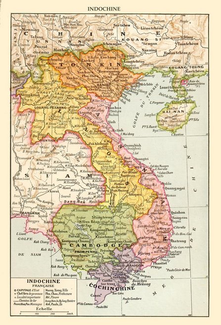
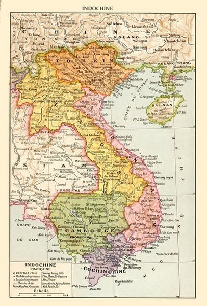
Description: Map of French Indochina from the colonial period showing its six subdivisions: Tonkin, Annam, Cochinchine, Cambodge, Laos and Kwangchow Wan.
Title: French Indochina c. 1930
Credit: http://indochine1940-1975.over-blog.com/pages/lINDOCHINE_FRANCAISE-526718.html
Author: French atlas from c. 1930
Usage Terms: Public domain
License: Public domain
Attribution Required?: No
Image usage
The following page links to this image:

All content from Kiddle encyclopedia articles (including the article images and facts) can be freely used under Attribution-ShareAlike license, unless stated otherwise.