
Image: French River (Massachusetts + Connecticut) map
Size of this preview: 258 × 599 pixels. Other resolutions: 103 × 240 pixels | 1,951 × 4,526 pixels.
Original image (1,951 × 4,526 pixels, file size: 3.29 MB, MIME type: image/jpeg)
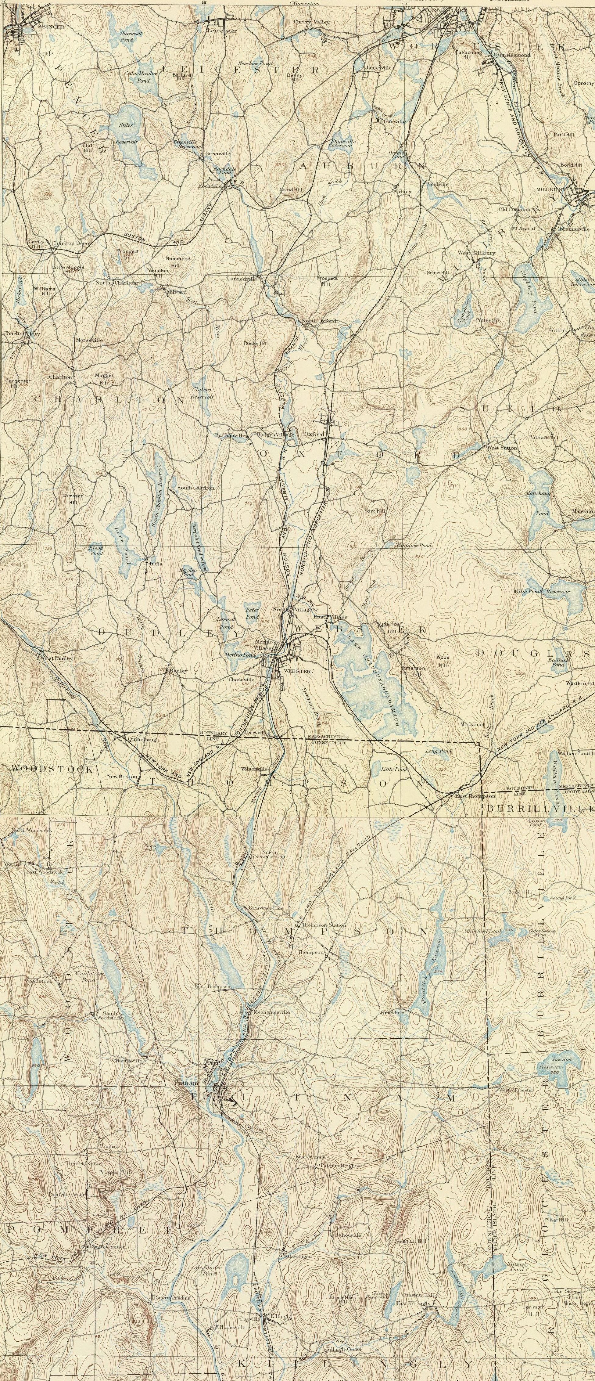
Description: Map of the French River and environs, Massachusetts and Connecticut, USA.
Title: French River (Massachusetts + Connecticut) map
Credit: This image is stitched together from 2 maps in the following series: United States Geological Survey, 1893, sheets for Massachusetts (Webster) and Connecticut (Putnam). Published in the Topographic Atlases for the Commonwealth of Massachusetts and State of Connecticut, 1893.
Author: United States Geological Survey, US Department of the Interior.
Permission: Public domain - original work of the US Federal Government.
Usage Terms: Public domain
License: Public domain
Attribution Required?: No
Image usage
The following page links to this image:

All content from Kiddle encyclopedia articles (including the article images and facts) can be freely used under Attribution-ShareAlike license, unless stated otherwise.
_map.jpg)