
Image: Futaba District vs Fukushima evacuation zones
No higher resolution available.
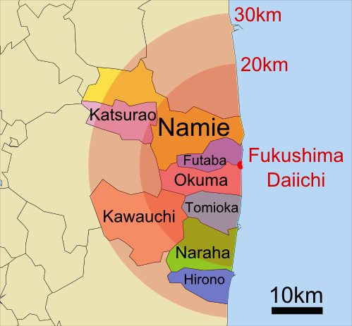
Futaba_District_vs_Fukushima_evacuation_zones.png (499 × 463 pixels, file size: 68 KB, MIME type: image/png)
Description: Sketch map showing the relative locations of the 8 Futaba District municipalities with regards to the Fukushima-Daiichi evacuation areas
Title: Futaba District vs Fukushima evacuation zones
Credit: derivative work: original source is File:Iitate_in_Fukushima_Prefecture_Ja.svg by User:Lincun
Author: ConradMayhew
Usage Terms: Creative Commons Attribution-Share Alike 3.0
License: CC BY-SA 3.0
License Link: http://creativecommons.org/licenses/by-sa/3.0
Attribution Required?: Yes
Image usage
The following 4 pages link to this image:

All content from Kiddle encyclopedia articles (including the article images and facts) can be freely used under Attribution-ShareAlike license, unless stated otherwise.