
Image: GLO map of Interbay and Magnolia claims - 1863
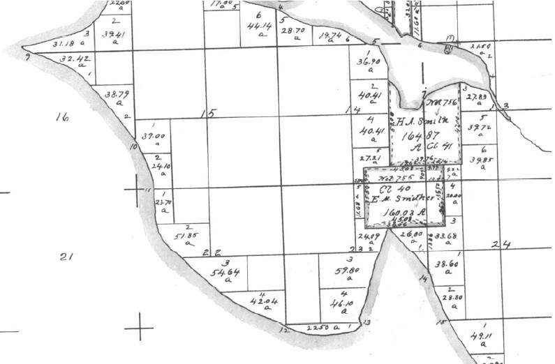
Description: Part of 1863 (United States) Government Land Office map showing what is now Interbay and most of Magnolia in Seattle Washington. Salmon Bay is to the north; Smith Cove juts in from the south. Note the claims by H. A. Smith and E. M. Smither. Smith eventually came to own Smither's claim. The map shows the natural shape of the land before the dredging of a canal to the northeast and the filling of much of the cove to the south.
Title: GLO map of Interbay and Magnolia claims - 1863
Credit: BOLA Architecture + Planning & Northwest Archaeological Associates, Inc., Port of Seattle North Bay Project DEIS: Historic and Cultural Resources, Port of Seattle, April 5, 2005. Accessed online 25 July 2008. Page 23 of the document (page 25 of the PDF).
Author: United States Government Land Office
Permission: PD-USGov
Usage Terms: Public domain
License: Public domain
Attribution Required?: No
Image usage
The following page links to this image:
