
Image: Galactic Empire Map V3
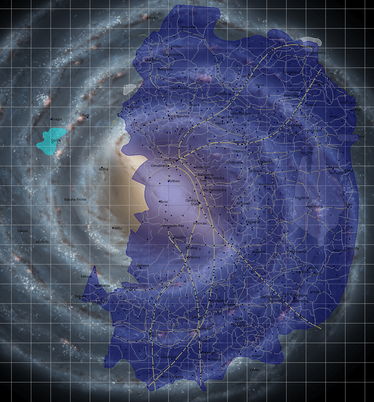
Description: As before, this is a map of the Galactic Empire from Star Wars. It was constructed with Legends sources, being supplemented with Canon wherever available. It shows all the sectors I could find as well as hyperlanes. Planets that I felt were iconic or important are labeled, but most charted systems are at least present on the map. Super detailed areas like Hapes were glossed over because too many systems right next to each other clogs the map. As for a key, the light grey lines are sectors, the darker grey are regions. Gold lines are hyperspace lanes with the thicker ones being the majors routes. Dark blue is officially owned by the Empire while lighter blue is semi-independent sectors. White planets and sectors are completely independent. The Chiss are the lightest shade of blue and are also independent.
Title: Galactic Empire Map V3
Credit: https://www.deviantart.com/zanzibar42/art/Galactic-Empire-Map-V3-815984861
Author: Zanzibar42
Usage Terms: Public domain
License: Public domain
Attribution Required?: No
Image usage
The following page links to this image:
