
Image: Gallapagos Islands 1684
Size of this preview: 369 × 600 pixels. Other resolutions: 147 × 240 pixels | 2,357 × 3,831 pixels.
Original image (2,357 × 3,831 pixels, file size: 10.46 MB, MIME type: image/jpeg)
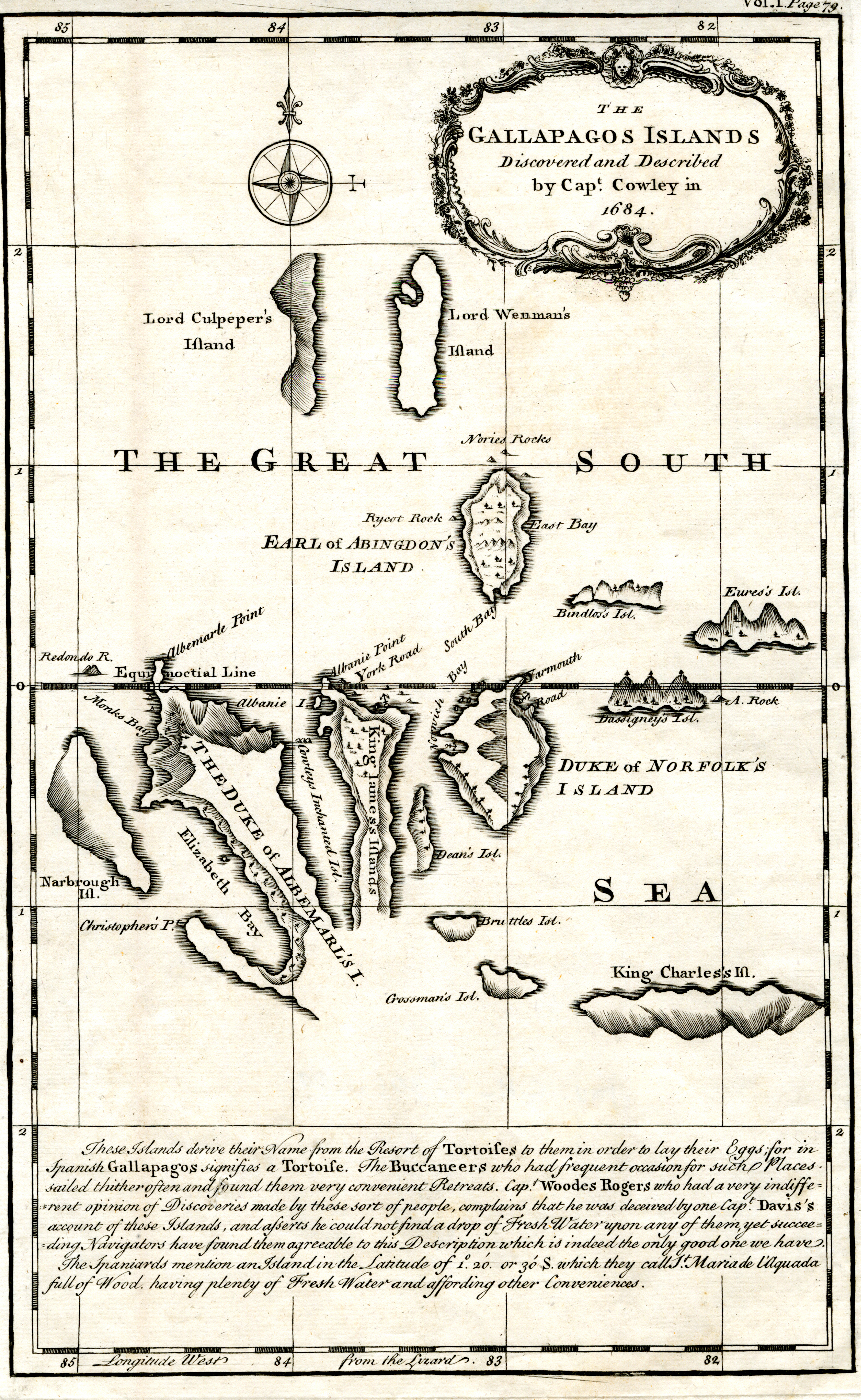
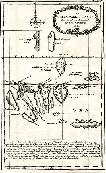
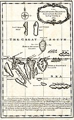
Description: Map of the Galapagos Islands as described by Ambrose Cowley in 1684.
Title: Gallapagos Islands 1684
Credit: A Chronological History of the Discoveries in the South Sea or Pacific Ocean ; illustrated with charts, volume 4 . Segunda Referencia: Hallada en una diapositiva de Consulta y acceso publico cuya información fue investigada de un libro y/o ejemplar de revisión custodiado en los Fondos Bibliográficos y Cartográficos (Sección Siglo XVIII o Etapa Colonial) del Archivo Histórico del Guayas; Guayaquil, Ecuador.Consultado y compartido por el usuario J. Javier García A.
Author: James Burney
Usage Terms: Public domain
License: Public domain
Attribution Required?: No
Image usage
The following 3 pages link to this image:

All content from Kiddle encyclopedia articles (including the article images and facts) can be freely used under Attribution-ShareAlike license, unless stated otherwise.