
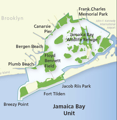
Image: Gateway National Recreation Area Jamaica Bay Unit map
No higher resolution available.
Gateway_National_Recreation_Area_Jamaica_Bay_Unit_map.jpg (412 × 423 pixels, file size: 49 KB, MIME type: image/jpeg)
Description: Map produced by the US National Park Service approximately 2010 depicting the major areas with the Jamaica Bay Unit of Gateway National Recreation Area. URL: http://www.nps.gov/gate/planyourvisit/map_jbu.htm
Title: Gateway National Recreation Area Jamaica Bay Unit map
Credit: Transferred from en.wikipedia by Ronhjones
Usage Terms: Public domain
License: Public domain
Attribution Required?: No
Image usage
The following 3 pages link to this image:

All content from Kiddle encyclopedia articles (including the article images and facts) can be freely used under Attribution-ShareAlike license, unless stated otherwise.