
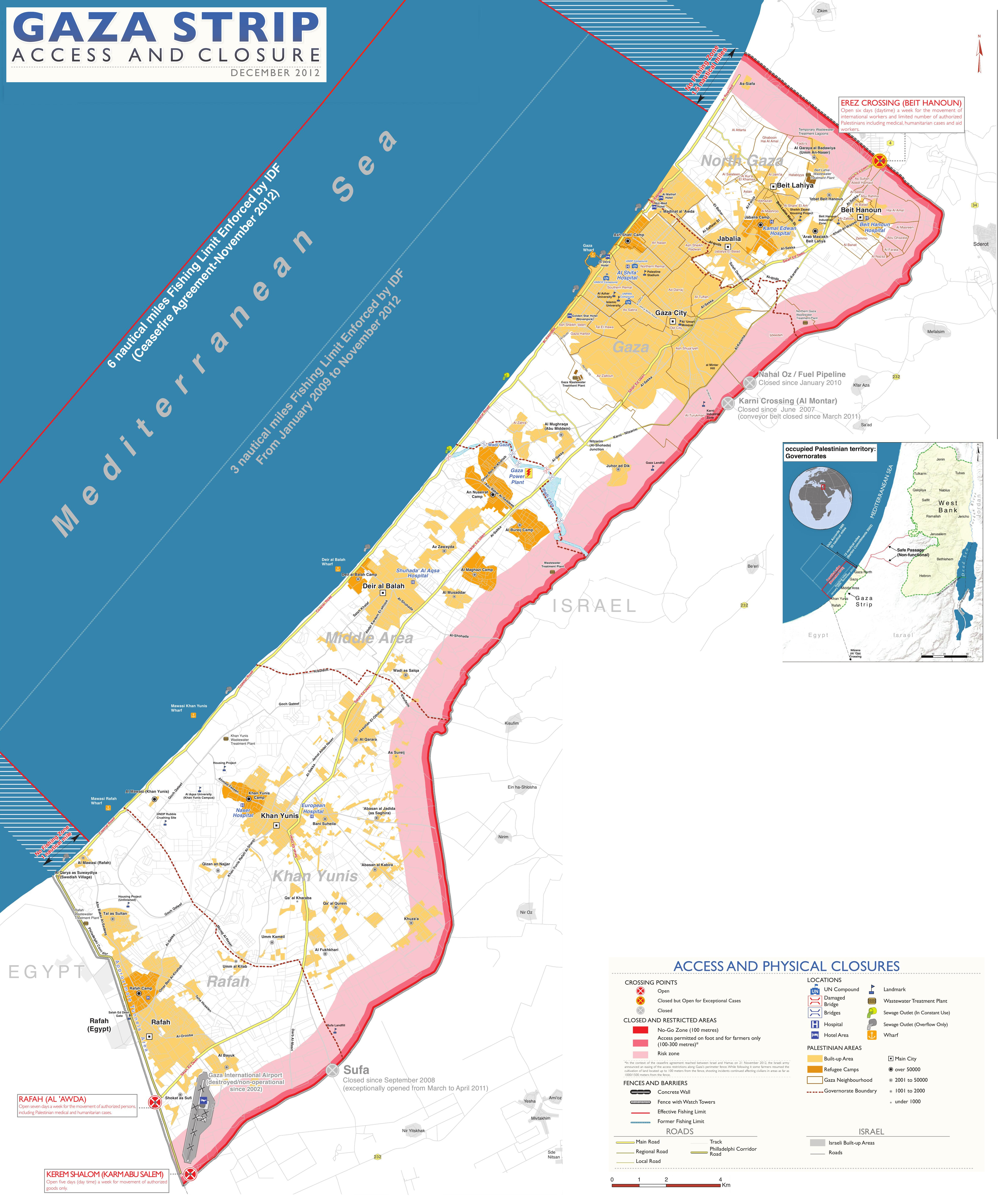
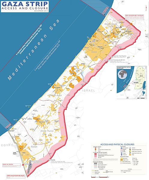
Image: Gaza closure December 2012
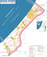
Size of this preview: 497 × 600 pixels. Other resolutions: 199 × 240 pixels | 4,732 × 5,712 pixels.
Original image (4,732 × 5,712 pixels, file size: 3.53 MB, MIME type: image/jpeg)
Description: Gaza Strip with Israeli-controlled borders and limited fishing zone, as of December 2012. Based on Closure Map: Gaza Strip Access and Closure, published by United Nations Office for the Coordination of Humanitarian Affairs (OCHAoPt), 22 February 2013
Title: Gaza closure December 2012
Credit: Own work, based on http://www.ochaopt.org/documents/ocha_opt_gaza_access_and_closure_map_december_2012.pdf (file size 18 MB!) on [1]
Author: Wickey-nl
Usage Terms: Creative Commons Attribution 3.0
License: CC BY 3.0
License Link: http://creativecommons.org/licenses/by/3.0
Attribution Required?: Yes
Image usage
There are no pages that link to this image.

All content from Kiddle encyclopedia articles (including the article images and facts) can be freely used under Attribution-ShareAlike license, unless stated otherwise.