
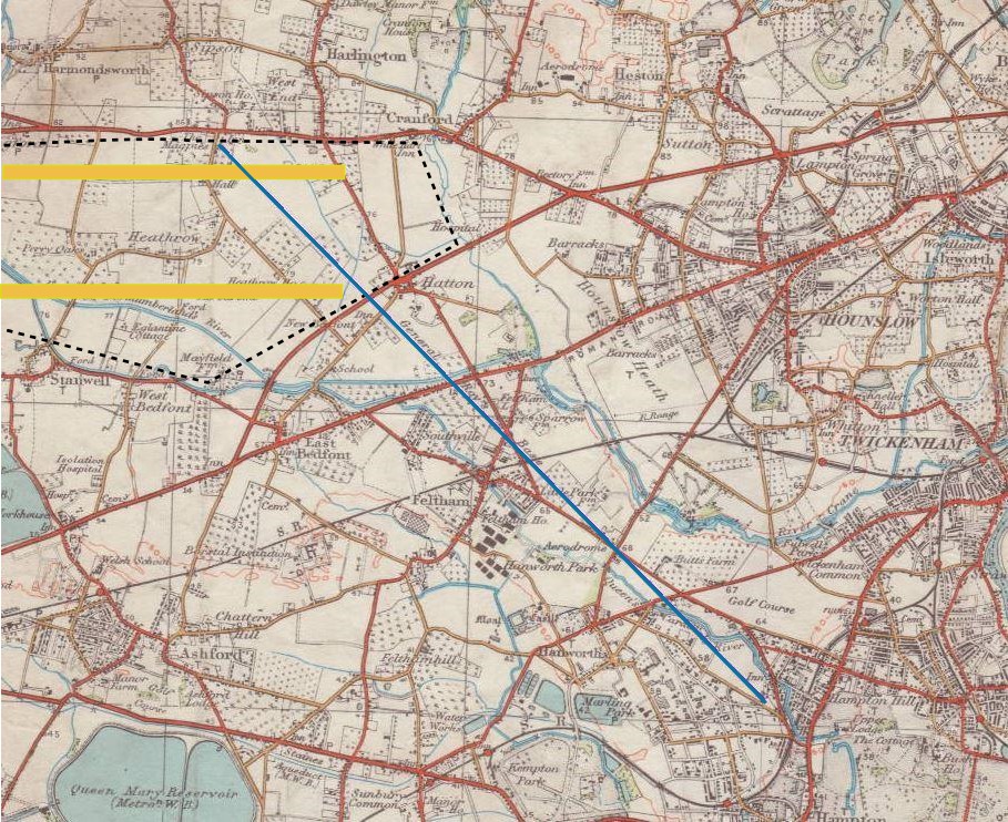
Image: General Roys Baseline
Size of this preview: 735 × 600 pixels. Other resolutions: 294 × 240 pixels | 909 × 742 pixels.
Original image (909 × 742 pixels, file size: 325 KB, MIME type: image/jpeg)
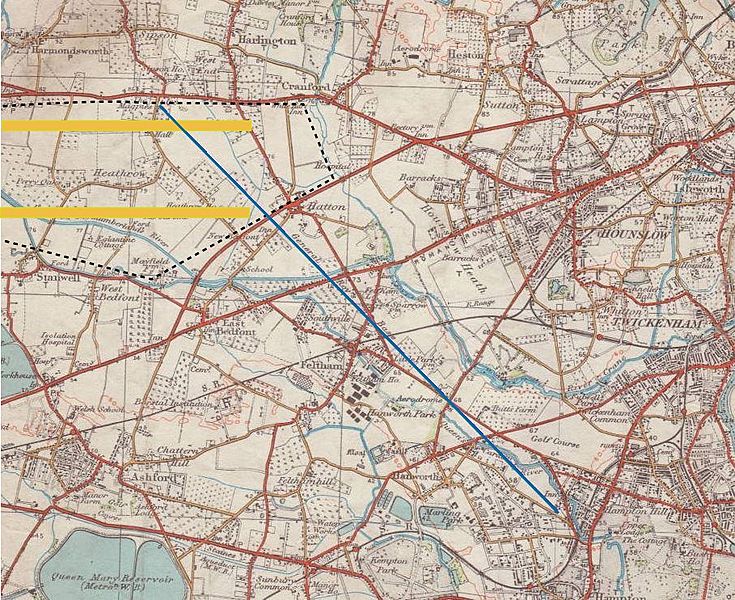
Description: General William Roy's survey baseline, from Heathrow to Hampton, west of London, constructed for the Anglo-French Survey before the start of the Ordnance Survey. See File:Heathrow Before World War II Map.jpg for a larger-scale map of the Heathrow area as it was around 1935.
Title: General Roys Baseline
Credit: from Ordnance Survey map
Author: Ordnance Survey
Usage Terms: Public domain
License: Public domain
Attribution Required?: No
Image usage
The following page links to this image:

All content from Kiddle encyclopedia articles (including the article images and facts) can be freely used under Attribution-ShareAlike license, unless stated otherwise.