
Image: Geosats compilation
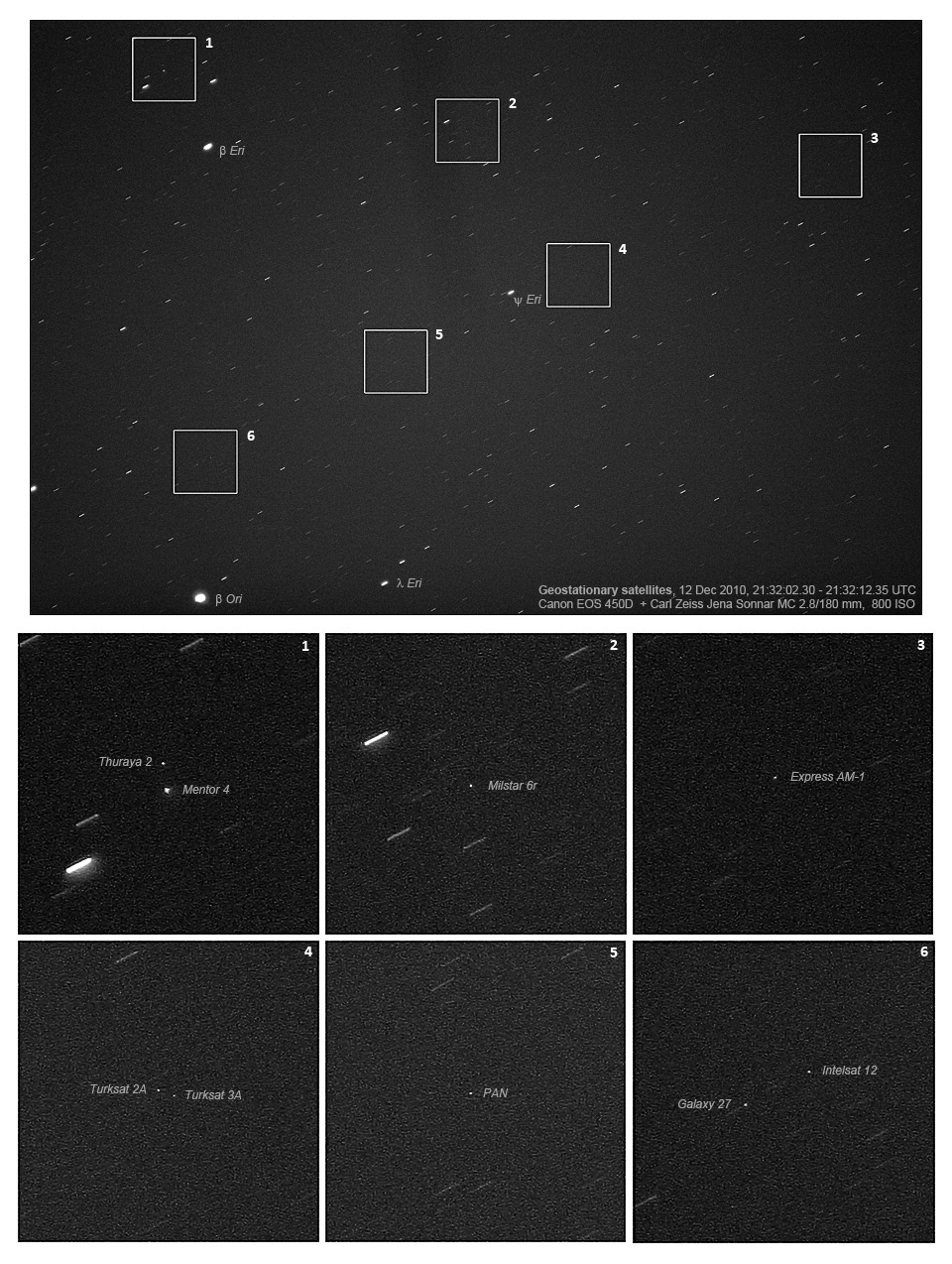
Description: A 5 x 6 degrees view of a part of the geostationary belt, showing several geostationary satellites. Those with inclination 0 degrees form a diagonal belt across the image: a few objects with small inclinations to the equator are visible above this line. Note how the satellites are pinpoint, while stars have created small trails due to the Earth's rotation. Image by Marco Langbroek, the Netherlands, 12 Dec 2010, with a Carl Zeiss Jena Sonnar MC 2.8/180mm lens, Canon EOS 450D @ 800 ISO, 10s exposure.
Title: Geosats compilation
Credit: Own work
Author: Marcoaliaslama
Usage Terms: Creative Commons Attribution-Share Alike 3.0
License: CC BY-SA 3.0
License Link: http://creativecommons.org/licenses/by-sa/3.0
Attribution Required?: Yes
Image usage
The following page links to this image:
