
Image: Geoservices server with apps
No higher resolution available.
Geoservices_server_with_apps.png (694 × 569 pixels, file size: 44 KB, MIME type: image/png)
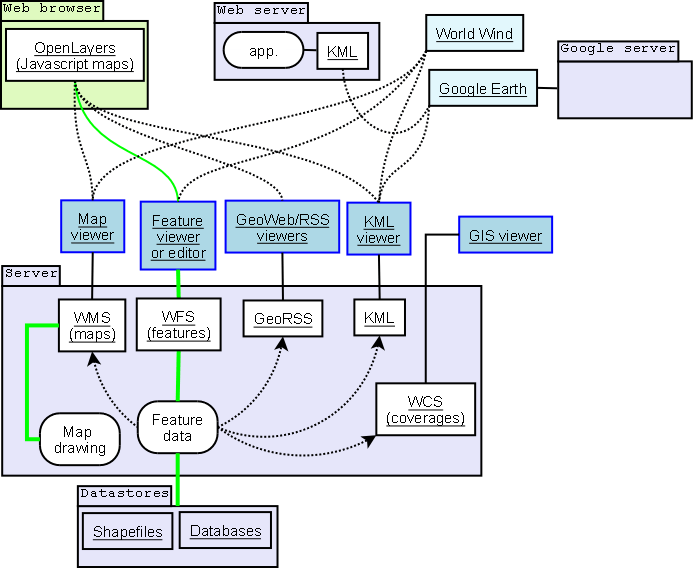
Description: Geoservices server with interfaces and applications sketch. Green represents read and write paths. Dotted arrowed line indicates mostly read-only data flow.
Title: Geoservices server with apps
Credit: Own work
Author: SEWilco
Usage Terms: GNU Free Documentation License
License: GFDL
License Link: http://www.gnu.org/copyleft/fdl.html
Attribution Required?: Yes
Image usage
The following page links to this image:

All content from Kiddle encyclopedia articles (including the article images and facts) can be freely used under Attribution-ShareAlike license, unless stated otherwise.