
Image: Ghor districts

Size of this preview: 776 × 600 pixels. Other resolutions: 311 × 240 pixels | 1,056 × 816 pixels.
Original image (1,056 × 816 pixels, file size: 27 KB, MIME type: image/png)
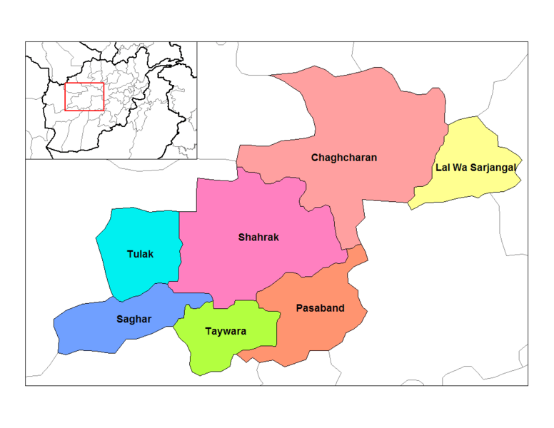
Description: Map of the districts of Ghor province of Afghanistan. Created by Rarelibra 19:24, 29 March 2007 (UTC) for public domain use, using MapInfo Professional v8.5 and various mapping resources.
Title: Ghor districts
Credit: No machine-readable source provided. Own work assumed (based on copyright claims).
Author: No machine-readable author provided. Rarelibra assumed (based on copyright claims).
Usage Terms: Public domain
License: Public domain
Attribution Required?: No
Image usage
There are no pages that link to this image.

All content from Kiddle encyclopedia articles (including the article images and facts) can be freely used under Attribution-ShareAlike license, unless stated otherwise.