
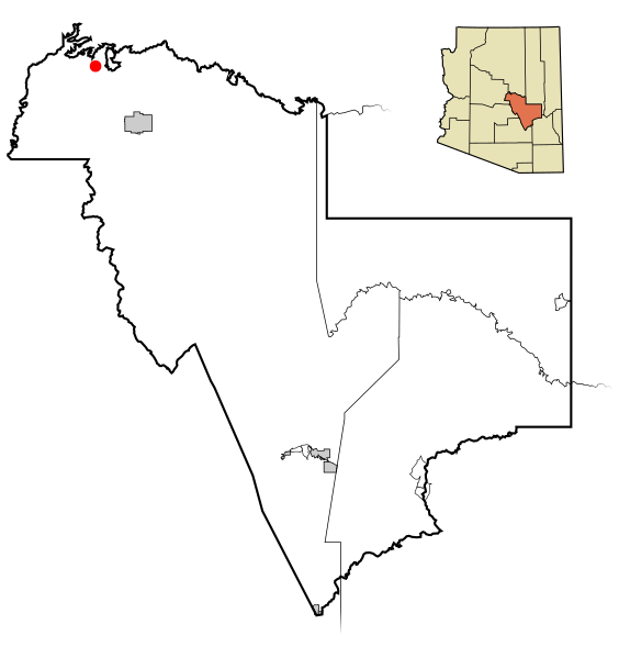
Image: Gila County Incorporated and Unincorporated areas Pine highlighted

Size of this PNG preview of this SVG file: 564 × 599 pixels. Other resolution: 226 × 240 pixels.
Original image (SVG file, nominally 800 × 850 pixels, file size: 96 KB)
Description: This map shows the incorporated areas and unincorporated areas in Gila County, Arizona. Pine is highlighted in red. Incorporated cities are shown in gray and unincorporated communities or CDPs are shown in white. Data for the borders and locations are based on maps from the US Census Bureau TIGER Map Server. I created this map in Inkscape.
Title: Gila County Incorporated and Unincorporated areas Pine highlighted
Credit: My own work, based on public domain information
Author: Ixnayonthetimmay
Usage Terms: Public domain
License: Public domain
Attribution Required?: No
Image usage
The following page links to this image:

All content from Kiddle encyclopedia articles (including the article images and facts) can be freely used under Attribution-ShareAlike license, unless stated otherwise.