
Image: Glen Fincastle Kirk in the Old Scottish Parish of Dull (abolished in 1975) - geograph.org.uk - 257277
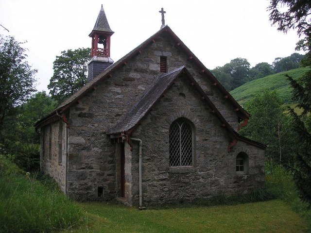
Description: Glen Fincastle Kirk in the Old Scottish Parish of Dull (abolished in 1975) Fincastle, a north-eastern district of Dull parish, Perthshire, extending 3½ miles along the N bank of the Tummel from the foot of Loch Tummel to Bonskeid House, and 1½ mile along the S bank of the Garry from Blair Athole village to Auldclune. Fincastle Burn flows through the midst to the Tummel, along a fertile narrow strath, and near its left bank stands Fincastle House, the seat and death-place of Sir Robert Gilmour Colquhoun, K.C.B. (1803-70), who for seven years served as ConsulGeneral in Egypt. The district takes its name from having anciently contained no fewer than fifteen castles, vestiges of a number of which may still be seen; and it gives the title of Viscount to the Earl of Dunmore. It has a post office under Pitlochry, 6 miles to the SE.Ord. Sur., sh. 55, 1869. (Frances Groome, Ordnance Gazetteer of Scotland (1882-4); © 2004 Gazetteer for Scotland) The parish consists of three distinct portions-the first containing Dull village, the second containing the greater part of Aberfeldy and also the village of Amulree, and the third or Garrow section, which, very much smaller than either of the others, lies 5¾ miles WNW of Amulree. Its total area is 64,730 acres, of which 1313 are water, whilst 47,2332/3 belong to the main body, and 17,4961/3 to the detached portions. The main body is bounded NW and NE by Blair Athole, E by Moulin, Logierait, and Little Dunkeld, S by detached portions of Logierait, Weem, and Fortingal, and SW and W by Fortingal. It has an utmost length of 133/8 miles from NW to SE, viz., from the north-western slope of Craig nan Garsean to a little beyond Loch Ceannard; its utmost width is 12 miles from NE to SW, viz., from the river Garry, opposite Auldclune, to the confluence of Keltney Burn with the Lyon.The said Lyon flows 1½ mile east-south-eastward along the southern border to the Tay; and the Tay itself at three different points has a total east-north-easterly course of 8¾ miles-2½ from the Lyon's confluence to just above Dunacree, ¾ mile along the northern border of the Aberfeldy section, and 5½ miles along the N of the Grandtully portion of the main body-descending during that course from 280 to 210 feet above sea-level. The Tummel winds 13 miles eastward along the northern border and through the northern interior, its expansion, Loch Tummel (2¾ x ½ mile), belonging half to Blair Athole and half to Dull; and the Garry, the Tummel's affluent, has here at two points a total east-south-easterly course of 1½ mile between Blair Athole and Auldclune villages. Lakes, other than Loch Tummel, are Loch Kinardochy (3 x 2 furl.), Lochan a' Chait (2½ x ¾ furl.), Loch Ceannard (5½ x 3 furl.), and five or six smaller ones dotted over the interior; Lochs Derculich (4¾ x 4 furl.) and Glassie (3½ x 11/3 furl.), partly belonging to Logierait; and Loch Bhaic (3 x 1 furl.), of which two-thirds are in Blair Athole. The surface sinks to about 210 feet above sea-level along the Tay, 360 along the Tummel, and 390 along the Garry; and the chief elevations are Grandtully Hill (1717 feet), to the S of the Tay; * Beinn Eagach (2259), Farragon Hill (2559), Weem H-ill (1638), the Rock of Dull (1557), Craig Odhar (1710), Meall Tarruin chon (2559), Dun Coilloch (1866), the *north-eastern shoulder (3100) of Schiehallion, and Craig Kynachar (1358), between the Tay and the Tummel; and, to the N of the Tummel, Meall na h-Iolaire (1443) and *Craig nan Garsean (1566), where asterisks mark those summits that culminate on the borders of the parish. The Aberfeldy and Amnlree portion, again, has an utmost length from N to S of 97/8 miles, and a varying breadth from E to W of ¾ mile and 4¾ miles, being bounded N by the Tay, E by Weem (detached), Little Dunkeld, and Fowlis-Wester, S by Crieff, and SW and W by detached sections of Fowlis-Wester, Monzie, Kenmore, Fortingal, and Logierait. In the S the Quaich has an east-south-easterly course of 33/8 miles, traversing Loch Freuchie (1¾ mile x 31/3 furl-), which mostly belongs to this portion of Dull, other lakes thereof being Loch Hoil(3 x 2½ furl-), Lochs na Craig (4 x 1 furl.) and Fender (2¾ x 2 furl-) on the eastern border, Lochan a'Mhuilinn (1½ x furl.), and Loch Uaine (2½ x ½ furl.). The surface sinks at Amulree to close on 900 feet, and the chief elevations to the S of the Quaich are *Geal Charn (2000 feet), *Beinn na Gainimh (2367), and *Meall nam Fuaran (2631), whilst to the N of it rise *Creag an Loch (1760), *Meall Dubh (2021), and Craig Forinal (1676). Lastly, the Garrow portion, measuring 33/8 by 1¾ miles, is bounded W and N by Kenmore, and on the other sides by detached sections of Weem and Monzie- The Quaich flows 3¾ miles along its northern border; and the surface, sinking at the north-eastern corner to 990 feet, thence rises to Garrow Hill (2402 feet), Carn Bad an Fhraoich (2619), and Carn nan Gahbhar (2790), all three of which culminate upon the southern border. Mica slate, occasionally interspersed with quartz, granite, chlorite, and hornblende slate, is the predominant rock; limestone forms a considerable bed, and is quarried at Tomphobuil; a bluish building stone, similar to chlorite and talc slate, occurs on the Aird of Appin; and marl, in small quantities, is found in several places. The soil, in some parts, is a thin mould or a brownish loam, mixed with sand; in others, is a mixture of clay and loam; in others, is light and gravelly; and in others, is of a wet mossy nature. Between 651 and 661 St Cuthbert, coming to a town called Dull, forsook the world, and became a solitary. On the summit of Doilweme, or Weem Hill, 1½ mile to the NE, he brought from the hard rock a fountain of running water, erected a large stone cross, built an oratory of wood, and hewed a bath out of a single stone. At Dull, within seventeen years of St Cuthbert's death in 687, Adamnan founded a monastery, which was dedicated to himself, and to which a very extensive territory was annexed-the 'abthanrie' or abbacy of Dull. Embracing a large portion of the western part of the earldom of Athole, and containing the two thanages of Dull and Fortingal, this was possessed in the first half of the 11th century by Crinan, lay abbot of Dunkeld, and ancestor both of the- royal dynasty that terminated with Alexander III. and of the ancient Earls of Athole (Skene's Celtic Scotland, vols. ii., iii., 1877-80). The antiquities include a number of- forts, cairns, and standing stones, a stone circle, and three moat-hills. Mansions, separately noticed, are Grandtully, Foss, Moness, and Derculich; and the chief proprietors are the Earl of Breadalbane, Sir Robert Menzies, and Sir Archibald Douglas-Drummond-Stewart, 4 others holding each an annual value of £500 and upwards, 6 of between £100 and £500,3 of from £50 to £100, and 6 of from £20 to £50. In the presbytery of Weem and synod of Perth and Stirling, this parish is divided ecclesiastically among Foss, Tenandry, Amulree, and Dull, the last a living worth £360. Dull parish church, a pre-Reformation edifice, consisting of nave and chancel, and, as recently renovated, containing 330 sittings, stands at the village; it was dedicated to St Adamnan, under his Celtic name of Eonan. Other places of worship are noticed under Aberfeldy, Amulree, Grandtully, and Tummel-Bridge. The public schools of Dull, Foss, Grandtully, and Tummel-Bridge, with respective accommodation for 95,48,75, and 38 children, had (1880) an average attendance of 44,13,48, and 20, and grants of £43,1s., £26,2s., £49,19s., and £35,1szaluation (1866) £16,754,9s. 3d., (1882) £19,759,5s.Pop. of parish (1801) 4055, (1831) 4590, (1861) 2945, (1871) 2681, (1881) 2578; of registration district (1871) 677, (1881)615. (Frances Groome, Ordnance Gazetteer of Scotland (1882-4); © 2004 Gazetteer for Scotland)
Title: Glen Fincastle Kirk in the Old Scottish Parish of Dull (abolished in 1975) - geograph.org.uk - 257277
Credit: From geograph.org.uk
Author: Sandy Gemmill
Usage Terms: Creative Commons Attribution-Share Alike 2.0
License: CC BY-SA 2.0
License Link: https://creativecommons.org/licenses/by-sa/2.0
Attribution Required?: Yes
Image usage
The following page links to this image:

_-_geograph.org.uk_-_257277.jpg)