
Image: Global tropical cyclone tracks-edit2
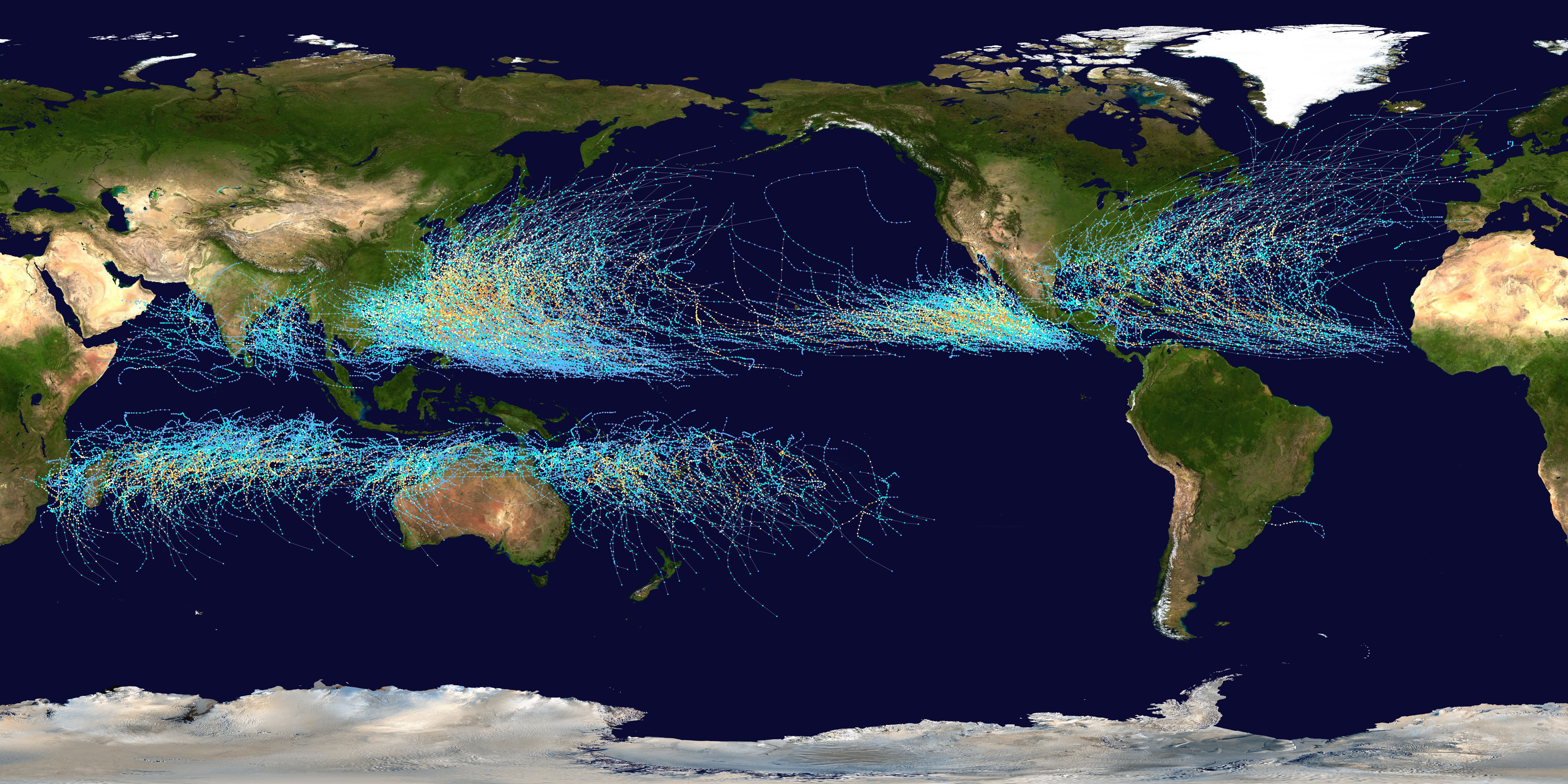
Description: This map shows the tracks of all Tropical cyclones which formed worldwide from 1985 to 2005. The points show the locations of the storms at six-hourly intervals and use the color scheme shown to the right from the Saffir-Simpson Hurricane Scale.
Title: Global tropical cyclone tracks-edit2
Credit: Created using User:jdorje/Tracks by Nilfanion on 2006-08-05. Background image from File:Whole_world_-_land_and_oceans.jpg (NASA). Tracking data for storms within the Atlantic and Eastern Pacific basins is taken from the National Hurricane Center and the Central Pacific Hurricane Center's Northeast and North Central Pacific hurricane database. The tracking data for storms within the Indian Ocean, the Northwest Pacific and the Southern Pacific is from the Joint Typhoon Warning Center. Tracking data for Cyclone Catarina in the South Atlantic was published in Gary Padgett's April 2004 Monthly Tropical Cyclone Summary and was originally produced by Roger Edson of the University of Guam.
Author: Background image: NASA this version: Nilfanion
Permission: I, the copyright holder of this work, release this work into the public domain. This applies worldwide. In some countries this may not be legally possible; if so: I grant anyone the right to use this work for any purpose, without any conditions, unless such conditions are required by law.
Usage Terms: Public domain
License: Public domain
Attribution Required?: No
Image usage
The following 2 pages link to this image:
