
Image: Gloucestershire UK location map

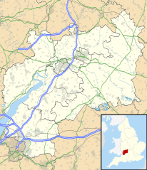
Description: Map of Gloucestershire, UK with the following information shown: Administrative borders Coastline, lakes and rivers Roads and railways Urban areas Equirectangular map projection on WGS 84 datum, with N/S stretched 160% Geographic limits: West: 2.70W East: 1.60W North: 52.16N South: 51.36N
Title: Gloucestershire UK location map
Credit: Ordnance Survey OpenData. Administrative borders and coastline data from Boundary-Line product. All other geographic data from Meridian 2 product. Inset derived from England location map.svg by Spischot.
Author: Nilfanion, created using Ordnance Survey data
Permission: This file is licensed under the Creative Commons Attribution-Share Alike 3.0 Unported license. Attribution: Contains Ordnance Survey data © Crown copyright and database right You are free: to share – to copy, distribute and transmit the work to remix – to adapt the work Under the following conditions: attribution – You must attribute the work in the manner specified by the author or licensor (but not in any way that suggests that they endorse you or your use of the work). share alike – If you alter, transform, or build upon this work, you may distribute the resulting work only under the same or similar license to this one. http://creativecommons.org/licenses/by-sa/3.0 CC BY-SA 3.0 Creative Commons Attribution-Share Alike 3.0 truetrue
Usage Terms: Creative Commons Attribution-Share Alike 3.0
License: CC BY-SA 3.0
License Link: http://creativecommons.org/licenses/by-sa/3.0
Attribution Required?: Yes
Image usage
The following 71 pages link to this image:
- Barrow Wake
- Belas Knap
- Berkeley, Gloucestershire
- Berkeley Castle
- Beverston Castle
- Bibury
- Bitton
- Bourton-on-the-Water
- Bradley Stoke
- Cannop Ponds
- Cecily Hill Barracks
- Chipping Campden
- Chipping Sodbury
- Church of the Holy Rood, Ampney Crucis
- Churchdown
- Cinderford
- Cirencester
- Cotswold Water Park
- Dorn, Gloucestershire
- Dowdeswell Reservoir
- Downend, South Gloucestershire
- Dursley
- Dymock Woods SSSI
- English Bicknor Castle
- Fairford
- Filton
- Fossil Beach (Sedbury Cliffs)
- Frenchay
- Hardwicke, Stroud
- Hawling
- Holy Trinity Church, Kingswood
- Kingswood, South Gloucestershire
- Lancaut
- Lechlade
- Little Sodbury
- Longford, Gloucestershire
- Longhope
- Lower Wye Gorge SSSI
- Lydney
- Minchinhampton
- Miserden Castle
- Mitcheldean
- Moreton-in-Marsh
- Nailsworth
- Newent
- Painswick
- Patchway
- Poulton Priory
- Puzzlewood
- RAF Down Ampney
- Robinswood Hill
- Selsley
- Severn Beach
- St Briavels Castle
- St Margaret's Church, Whaddon
- St Mary's Church, Kempley
- Staple Hill, Gloucestershire
- Stonehouse, Gloucestershire
- Stow-on-the-Wold
- Stroud
- Tetbury
- Tewkesbury
- Thornbury, Gloucestershire
- Uley
- Whitefield's Tabernacle, Kingswood
- Wickwar
- Winchcombe
- Workmans Wood, Sheepscombe
- Wotton-under-Edge
- Yate
- Template:Location map United Kingdom Gloucestershire
