
Image: Gold Belt Tour Scenic and Historic Byway - View of Florissant Valley and Teller 1 - NARA - 7718671
Size of this preview: 800 × 492 pixels. Other resolutions: 320 × 197 pixels | 2,590 × 1,593 pixels.
Original image (2,590 × 1,593 pixels, file size: 748 KB, MIME type: image/jpeg)
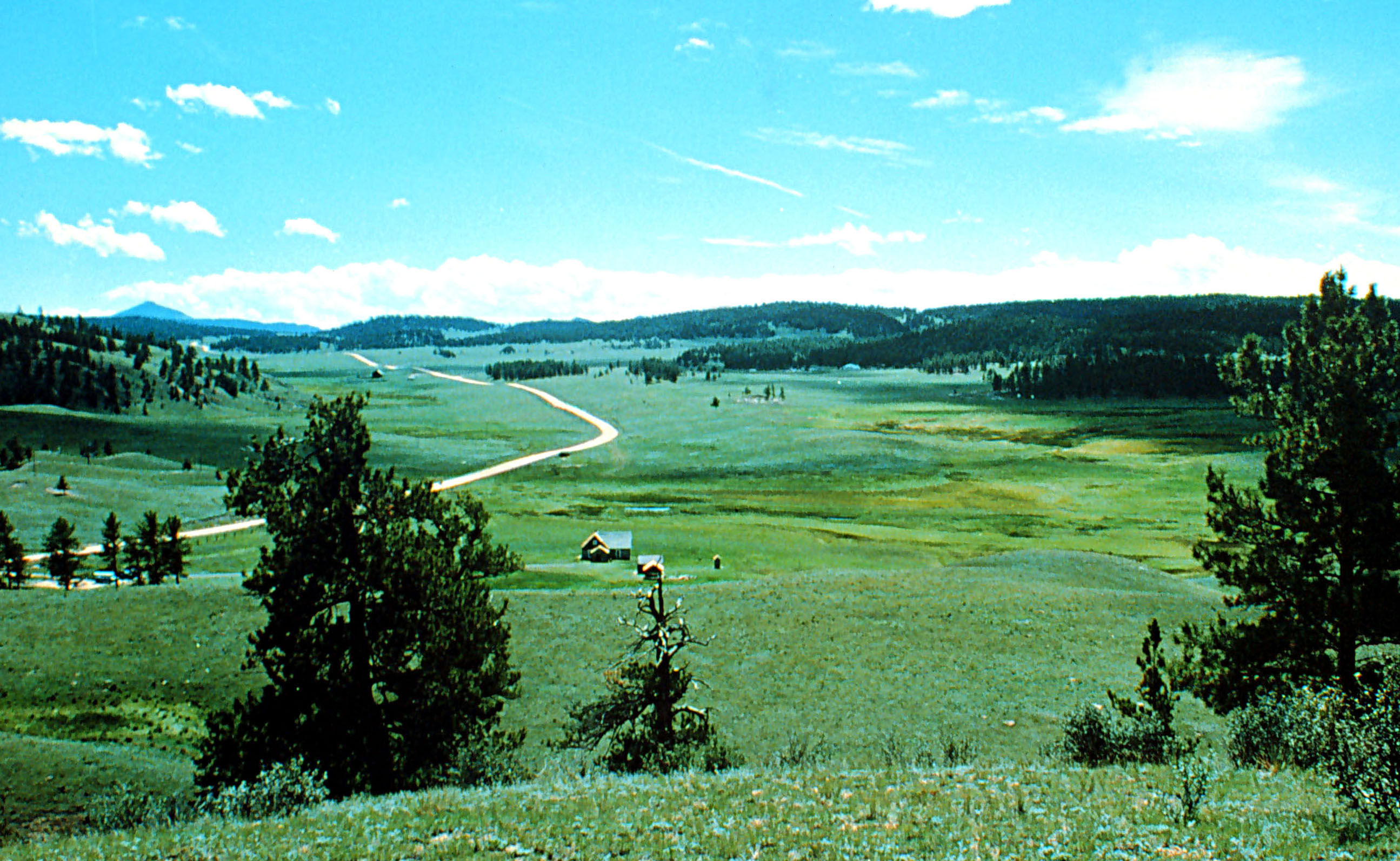
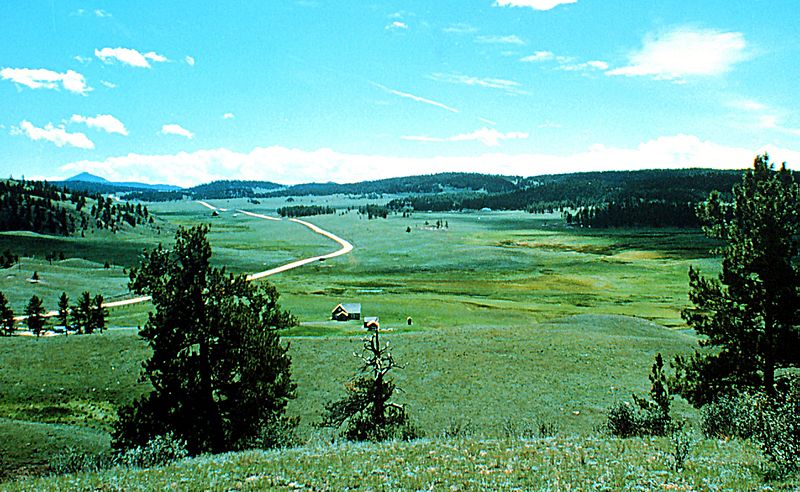
Description: Scope and content: The original finding aid described this photograph as: Original Caption: Teller 1, the northernmost portion of the Gold Belt Tour, winds through the pastoral Florissant Valley. The valley is located in an ancient lakebed. Location: Location: Florissant Valley, Colorado (38.405° N 105.143° W) Status: Public domain. Courtesy of the National Park Service
Title: Gold Belt Tour Scenic and Historic Byway - View of Florissant Valley and Teller 1
Credit: U.S. National Archives and Records Administration
Author: Unknown authorUnknown author or not provided
Usage Terms: Public domain
License: Public domain
Attribution Required?: No
Image usage
The following page links to this image:

All content from Kiddle encyclopedia articles (including the article images and facts) can be freely used under Attribution-ShareAlike license, unless stated otherwise.