
Image: Goths4
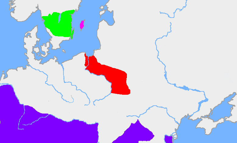
Description: The red area is the extent of the en:Wielbark culture in the first half of the en:3rd century. The green area is the en:Götaland, and the pink area is the island of en:Gotland. The dark blue area is the en:Roman Empire (this map description was corrected on 10 April 2023; for reference see https://commons.wikimedia.org/wiki/File:Chernyakhov.PNG) My own map, based on en:User:Dbachmann's blank map. The extent of the Wielbark culture is based on Zbigniew Babik: "Najstarsza warstwa nazewnicza na ziemiach polskich" Cracow 2001. See also John Haywood, Cassell's Atlas of World History, Cassel Reference, 2001. pp. 1.21, 2.19.
Title: Goths4
Credit: Transferred from en.wikipedia to Commons.
Author: The original uploader was Wiglaf at English Wikipedia.
Usage Terms: Creative Commons Attribution-Share Alike 3.0
License: CC BY-SA 3.0
License Link: http://creativecommons.org/licenses/by-sa/3.0/
Attribution Required?: Yes
Image usage
The following page links to this image:
