
Image: Govia Thameslink Railway Map

Size of this PNG preview of this SVG file: 459 × 600 pixels. Other resolution: 184 × 240 pixels.
Original image (SVG file, nominally 512 × 669 pixels, file size: 491 KB)
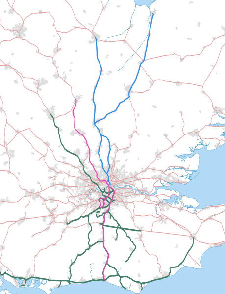
Description: Map showing railway routes to be operated by Govia Thameslink Railway. The background map shows the coastline and major urban areas. Equirectangular map projection on WGS 84 datum, with N/S stretched 160%
Title: Govia Thameslink Railway Map
Credit: Ordnance Survey OpenData. Great Britain coastline and boundary data from Boundary-Line product. Railway route and urban area data from Meridian 2 product.
Author: JaJaWa adapted from Nilfanion
Usage Terms: Creative Commons Attribution-Share Alike 4.0
License: CC BY-SA 4.0
License Link: http://creativecommons.org/licenses/by-sa/4.0
Attribution Required?: Yes
Image usage
The following page links to this image:

All content from Kiddle encyclopedia articles (including the article images and facts) can be freely used under Attribution-ShareAlike license, unless stated otherwise.