
Image: Gramercy Park 1853 real estate map
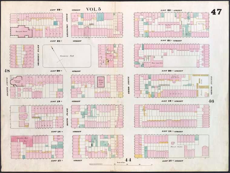
Description: Image Title: [Plate 47: Map bounded by East 22nd Street, Second Avenue, *East 17th Street, Fourth Avenue.] Creator: Perris, William -- Cartographer Additional Name(s): Perris & Browne -- Publisher Medium: Lithographs -- Hand-colored Item/Page/Plate: Plate 47 Source: Atlases of New York city. / Maps of the city of New York. Source Description: 1 atlas (7 v.) : col. maps ; 68 cm. Location: Stephen A. Schwarzman Building / The Lionel Pincus and Princess Firyal Map Division Catalog Call Number: Map Div.+++ (New York City) (Perris, W. Maps of the city of New York. 1857) Digital ID: 1268337 Record ID: 667175 Digital Item Published: 6-30-2005; updated 2-23-2010
Title: Gramercy Park 1853 real estate map
Credit: New York Public Library Digital Gallery
Author: William Perris
Usage Terms: Public domain
License: Public domain
Attribution Required?: No
Image usage
The following page links to this image:
