
Image: Grand Island NY aerial
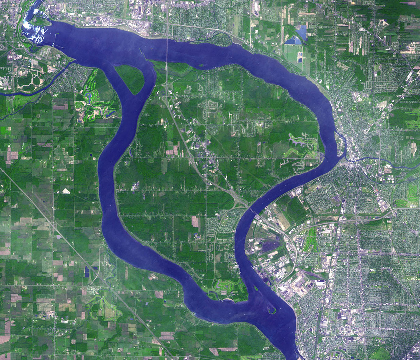
Description: This is a satellite image of the Niagara Falls region, acquired on September 8, 2001 by the Advanced Spaceborne Thermal Emission and Reflection Radiometer (ASTER) on NASA’s Terra satellite. I rotated so north is directly up, and cropped it so it focuses on Grand Island. Grand Island is at the center. Niagara Falls is at the extreme top and left. Canada is to the south and west; Erie County (NY) is east; Niagara County (NY) is north. Image courtesy NASA/GSFC/MITI/ERSDAC/JAROS, and U.S./Japan ASTER Science Team. Source: http://earthobservatory.nasa.gov/Newsroom/NewImages/images.php3?img_id=10921
Title: Grand Island NY aerial
Usage Terms: Public domain
License: Public domain
Attribution Required?: No
Image usage
The following page links to this image:
