
Image: Grand Rapids, Michigan 1955 Yellow Book
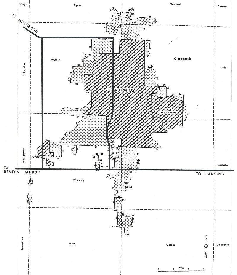
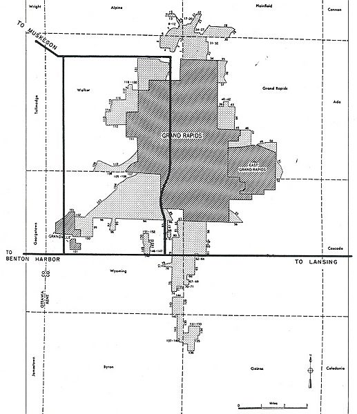
Description: City map from the 1955 "Yellow Book" of Interstate Highway System plans Interstates in today's terms (very rough assignment; part of what corresponds to I-96 is actually I-296, for example) I-96 I-196 I-296
Title: Grand Rapids, Michigan 1955 Yellow Book
Credit: This file is a direct scan by Adam Froehlig from the following book: Bureau of Public Roads (September 1955). "Grand Rapids" (Map). General Location of National System of Interstate Highways Including All Additional Routes at Urban Areas Designated in September 1955 Scale not given. Washington, DC: Government Printing Office. p. 43. OCLC 4165975. The Bureau of Public Roads (BPR) was originally a part of the United States Department of Agriculture then the United States Department of Commerce. The BPR is the predecessor agency to the Federal Highway Administration, a part of the United States Department of Transportation. This tag does not indicate the copyright status of the attached work. A normal copyright tag is still required. See Commons:Licensing for more information.
Author: Public Roads Administration - Federal Works Agency (predecessor to the United States Department of Transportation).
Permission: This image or file is a work of a United States Department of Commerce employee, taken or made as part of that person's official duties. As a work of the U.S. federal government, the image is in the public domain.
Usage Terms: Public domain
License: Public domain
Attribution Required?: No
Image usage
The following page links to this image:
