
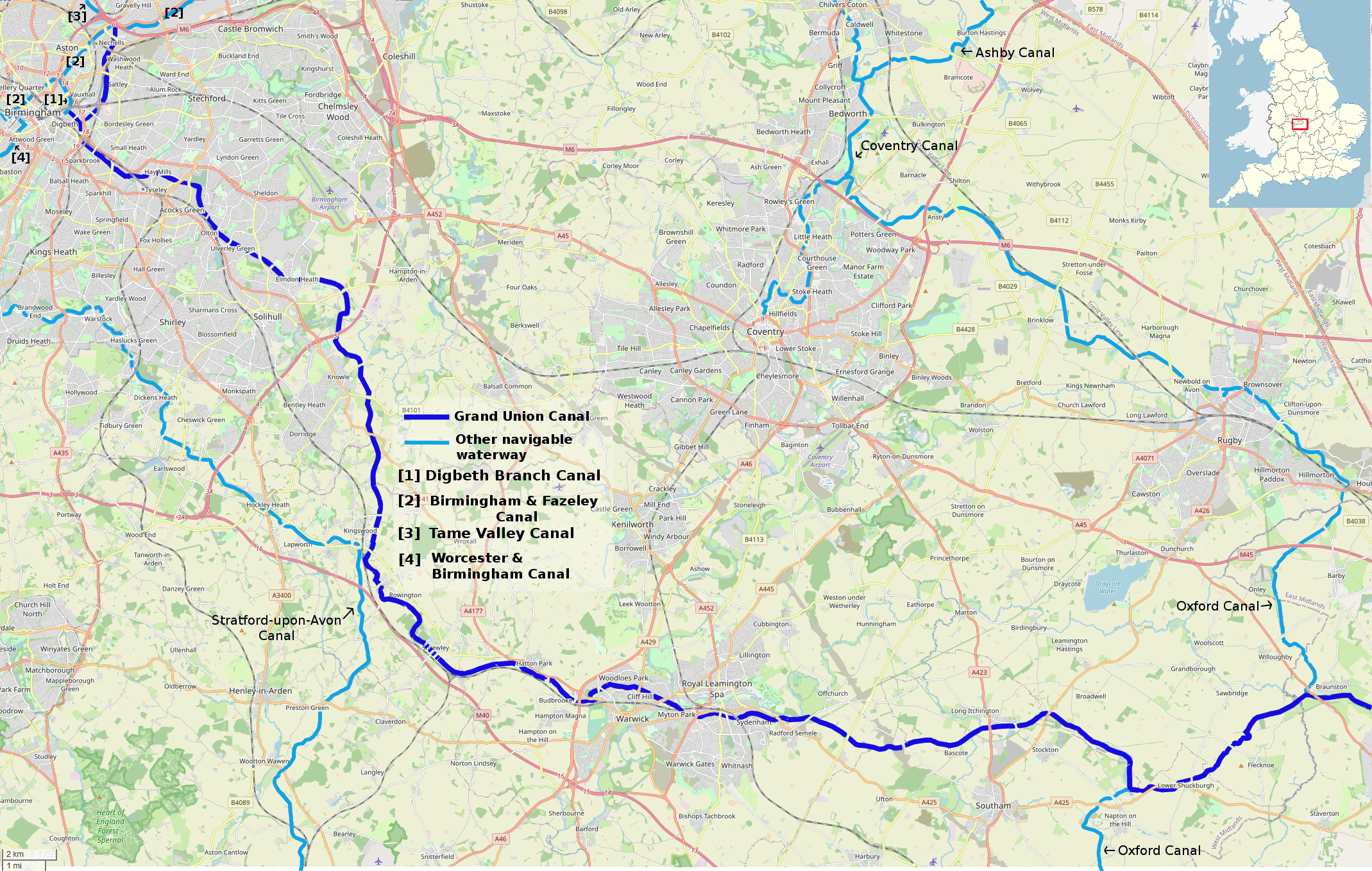
Image: Grand Union Canal, Braunston-Birmingham
Description: Map of the Braunston and Birmingham section of the Grand Union Canal, including connections.This map was created from OpenStreetMap project data, collected by the community. This map may be incomplete, and may contain errors. Don't rely solely on it for navigation.
Title: Grand Union Canal, Braunston-Birmingham
Credit: openstreetmap.org
Author: Own work, derived from open street map.
Permission: OpenStreetMap data is available under the Open Database License (details). Standard style map tiles are licensed as ODbL Produced Works. Contains information from OpenStreetMap, which is made available under the Open Database License (ODbL). The ODbL does not require any particular license for maps produced from ODbL data. Prior to 1 August 2020, map tiles produced by the OpenStreetMap Foundation were licensed under the CC-BY-SA-2.0 license. Maps produced by other people may be subject to other licences.Open Database LicenseODbLhttp://opendatacommons.org/licenses/odbl/1.0/true
Usage Terms: Open Database License
License: ODbL
License Link: http://opendatacommons.org/licenses/odbl/1.0/
Attribution Required?: Yes
Image usage
The following page links to this image:
