
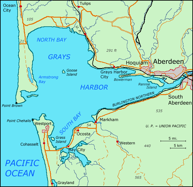
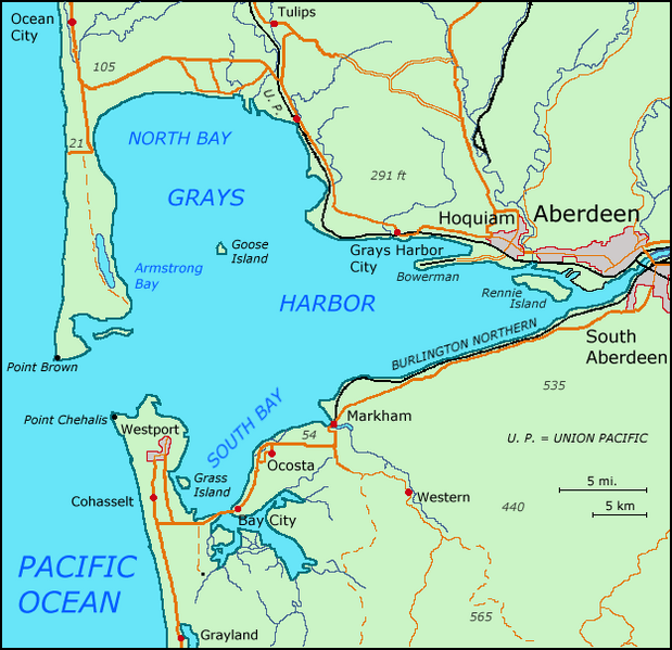
Image: GraysHarbor
Size of this preview: 619 × 599 pixels. Other resolutions: 248 × 240 pixels | 624 × 604 pixels.
Original image (624 × 604 pixels, file size: 62 KB, MIME type: image/png)
Description: Map of Grays Harbor, WA / Karte von Grays Harbor, WA
Title: GraysHarbor
Credit: self-made, based on Scans of Maps by the USGS (Chehalis River, Westport, Shelton) - 30X60 series
Author: Matthiasb
Usage Terms: Public domain
License: Public domain
Attribution Required?: No
Image usage
The following 2 pages link to this image:

All content from Kiddle encyclopedia articles (including the article images and facts) can be freely used under Attribution-ShareAlike license, unless stated otherwise.