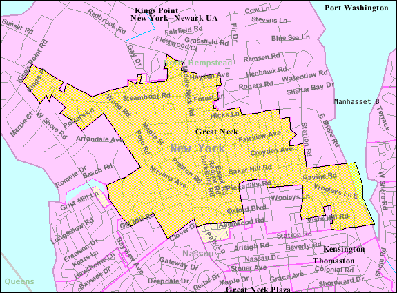
Image: Great-neck-ny-map
Description: U.S. Census 2000 reference map for Great Neck, New York. The amber and light cross-hatched areas bordered in magenta indicate the census tracts included in the census-designated place. The amber-colored areas bordered in black indicate the extent of the incorporated Village of Great Neck. The extent of "Great Neck, New York" as the term is used by the United States Postal Service, local government and local residents includes all the incorporated and unincorporated areas of the entire Great Neck peninsula, as well as an area south of the peninsula extending to the border with Queens (New York City).
Title: Great-neck-ny-map
Credit: http://factfinder.census.gov Transferred from en.wikipedia by SreeBot
Author: United States Census Bureau Uploaded by Americasroof at en.wikipedia
Permission: Public domain
Usage Terms: Public domain
License: Public domain
Attribution Required?: No
Image usage
The following page links to this image:


