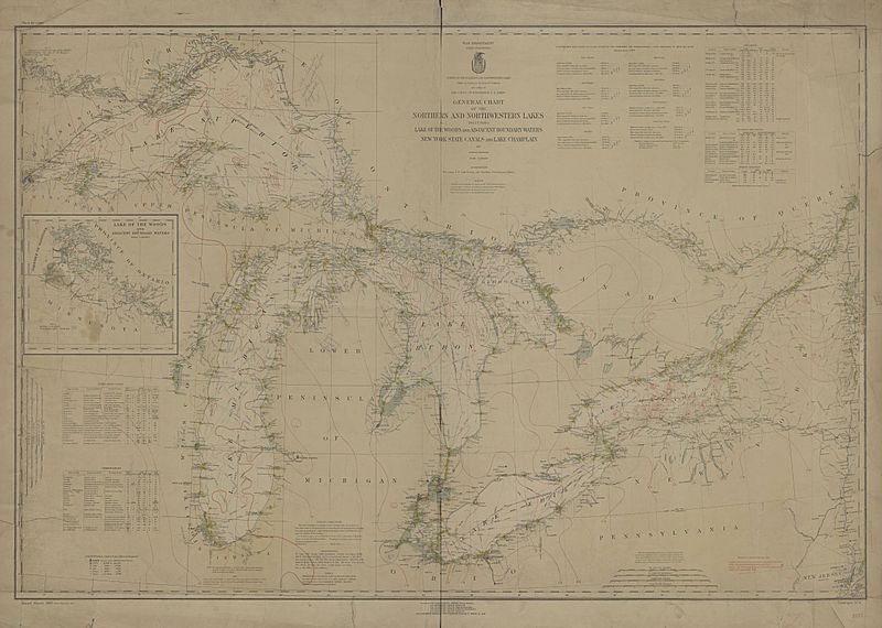
Image: Great Lakes, historical map, 1933 - DPLA - 98f2381d4b8282a70b87bf2490376dc2

Description: Historical map of the North American Great Lakes published in 1933 by the War Department Corps of Engineers.""Survey of the Northern and Northwestern Lakes"" as commissioned by U.S Congress. This map shows Lake Superior, Lake Michigan, Lake Huron, Lake Erie, Lake Ontario, Lake Champlain and the Lake of the Woods, as well as canals and waterways connecting to these bodies of water. The map does not display political subdivisions overland, but does show the international boundary lines over the pictured lakes.
Title: Great Lakes, historical map, 1933
Credit: This file was contributed to Wikimedia Commons by Toledo-Lucas County Public Library as part of a cooperation project. The donation was facilitated by the Digital Public Library of America, via its partner Ohio Digital Network. Source record: http://www.ohiomemory.org/cdm/ref/collection/p16007coll33/id/112943 DPLA identifier: 98f2381d4b8282a70b87bf2490376dc2
Permission: This image might not be in the public domain outside of the United States; this especially applies in the countries and areas that do not apply the rule of the shorter term for US works, such as Canada, Mainland China (not Hong Kong or Macao), Germany, Mexico, and Switzerland. The creator and year of publication are essential information and must be provided. See Wikipedia:Public domain and Wikipedia:Copyrights for more details.
Usage Terms: Public domain
License: Public domain
Attribution Required?: No
Image usage
There are no pages that link to this image.

