
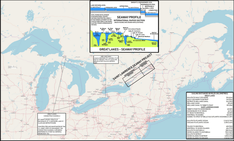
Image: Great Lakes and St. Lawrence Seaway map 1959

Size of this preview: 800 × 482 pixels. Other resolutions: 320 × 193 pixels | 2,627 × 1,583 pixels.
Original image (2,627 × 1,583 pixels, file size: 3.63 MB, MIME type: image/png)
Description: Map of the North American Great Lakes and the St. Lawrence Seaway.
Title: Great Lakes and St. Lawrence Seaway map 1959
Credit: Based on: U.S. Navy All Hands magazine September 1959, p. 9. Also used and partly incorporated were File:Great Lakes 2.PNG and File:Water transport lock horizontal and sectional drawing.png. Map from openstreetmap.org.
Author: Cobatfor
Usage Terms: Creative Commons Attribution-Share Alike 3.0
License: CC BY-SA 3.0
License Link: https://creativecommons.org/licenses/by-sa/3.0
Attribution Required?: Yes
Image usage
The following 2 pages link to this image:

All content from Kiddle encyclopedia articles (including the article images and facts) can be freely used under Attribution-ShareAlike license, unless stated otherwise.