
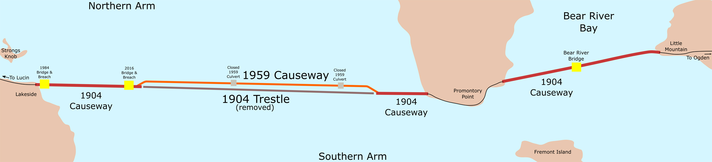
Image: Great Salt Lake Causeway Map 2016
Size of this preview: 800 × 182 pixels. Other resolutions: 320 × 73 pixels | 2,500 × 569 pixels.
Original image (2,500 × 569 pixels, file size: 322 KB, MIME type: image/jpeg)
Description: A map of the railroad causeway crossing the Great Salt Lake. The map shows past and present causeway parts, along with some geographical highlights of the area.
Title: Great Salt Lake Causeway Map 2016
Credit: Own work
Author: Beneathtimp
Usage Terms: Creative Commons Zero, Public Domain Dedication
License: CC0
License Link: http://creativecommons.org/publicdomain/zero/1.0/deed.en
Attribution Required?: No
Image usage
The following page links to this image:

All content from Kiddle encyclopedia articles (including the article images and facts) can be freely used under Attribution-ShareAlike license, unless stated otherwise.