
Image: Great Slave Lake Sat
No higher resolution available.
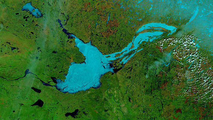
Great_Slave_Lake_Sat.jpg (709 × 399 pixels, file size: 113 KB, MIME type: image/jpeg)
Description: These true- and false-color images of central Canada show the Great Slave Lake in the Northwest Territories (top) and Lake Athabasca to the southeast. Lake Athabasca straddles the border between Alberta (west) and Saskatchewan (east). A fire (red dot) is burning in Alberta, and the snow capped Rocky Mountains cut through southwest Alberta at bottom left. In the false-color image, vegetation is green, water is dark blue, and ice (or snow) is light blue. -NASA
Title: Great Slave Lake Sat
Credit: NASA Visible Earth
Author: NASA
Usage Terms: Public domain
License: Public domain
Attribution Required?: No
Image usage
The following page links to this image:

All content from Kiddle encyclopedia articles (including the article images and facts) can be freely used under Attribution-ShareAlike license, unless stated otherwise.