
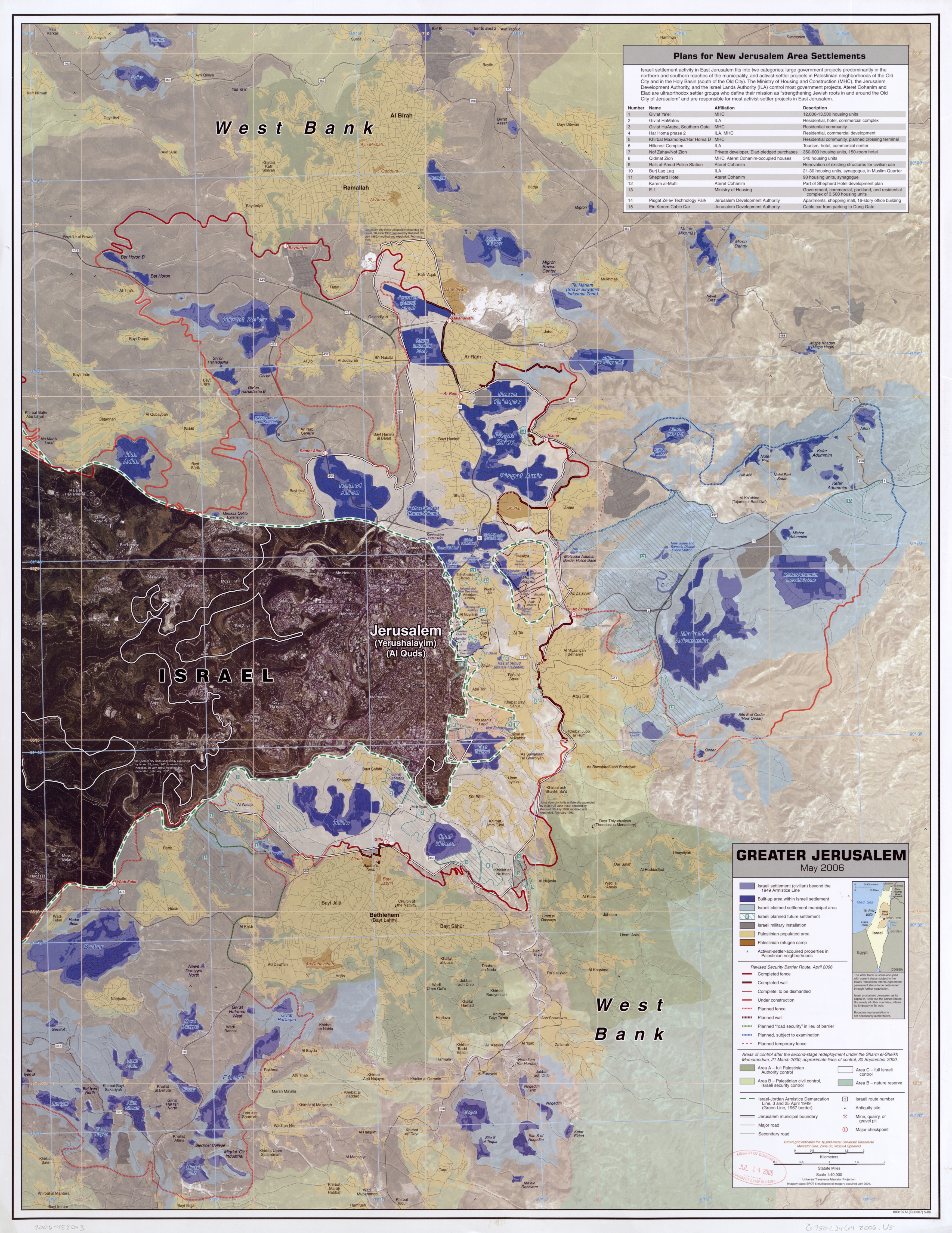
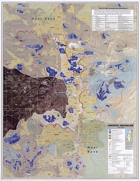
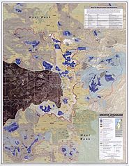
Image: Greater Jerusalem May 2006 CIA remote-sensing map 3500px
Description: Greater Jerusalem, May 2006. United States. Central Intelligence Agency. CREATED/PUBLISHED [Washington, D.C.] : Central Intelligence Agency, [2006] NOTES Shows settlements, refugee camps, fences, walls, etc. "Imagery base: SPOT 5 multispectral imagery acquired July 2004." Includes chart describing plans for new settlements. "803197AI (G00307) 5-06." Scale 1:40,000 ; universal transverse Mercator proj. (E 35006'--E 35021'/N 31054'--N 310390). MEDIUM 1 remote-sensing map : col. ; 87 x 67 cm. CALL NUMBER G7504.J4G4 2006 .U5 REPOSITORY Library of Congress Geography and Map Division Washington, D.C. 20540-4650 USA DIGITAL ID g7504j ct001915 http://hdl.loc.gov/loc.gmd/g7504j.ct001915 Note:Image converted from jp2 -> jpg
Title: Greater Jerusalem May 2006 CIA remote-sensing map 3500px
Credit: Greater_Jerusalem_May_2006_CIA_remote-sensing_map_.jpg This is a 3500-pixel-wide version of the above-linked original map that is 8,264 × 10,696 pixels, with a file size of 53.3 MB. This 3500-pixel-wide version is 5.54 MB.
Author: Greater_Jerusalem_May_2006_CIA_remote-sensing_map_.jpg: CIA derivative work: Timeshifter (talk)
Usage Terms: Public domain
License: Public domain
Attribution Required?: No
Image usage
The following 2 pages link to this image:
