
Image: Grimancreekmap
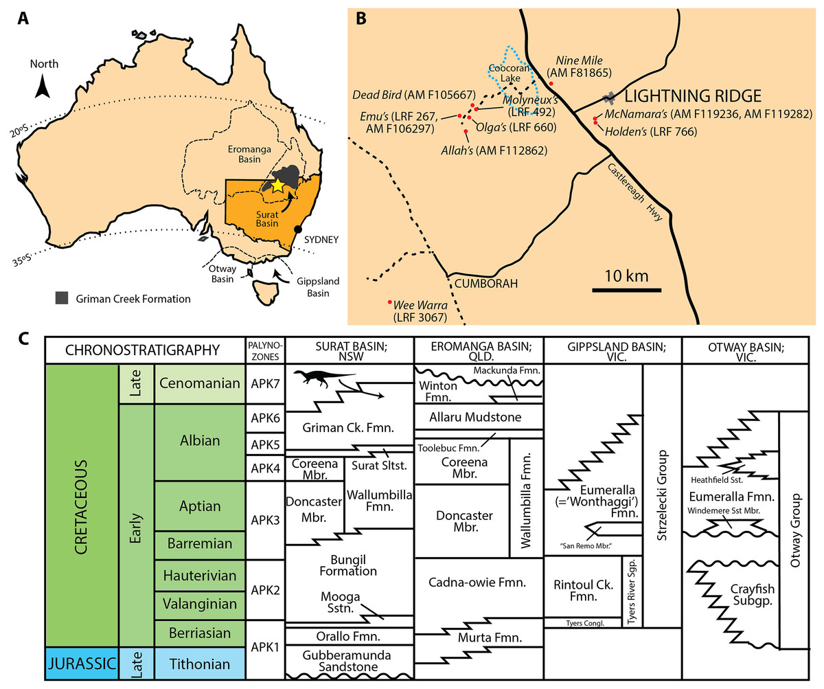
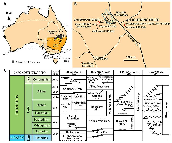
Description: (A) Present day map of Australia with the town of Lightning Ridge indicated by the star. (B) Regional map of the Lightning Ridge region showing localities (where known) for specimens described in this text. Sealed (solid black lines) and unsealed roads (dashed lines) are indicated. The ephemeral Coocoran Lake is marked with a dotted blue line. (C) Correlative stratigraphy of the major Cretaceous depositional basins and geological units discussed in this study. The ornithopod icon and arrow indicate the approximate level of the Griman Creek Formation from which the current material pertains. Informal units are in quotation marks. Maps in (A) and (B) redrawn and modified from Bell et al. (2016) and Opal Fields—Lightning Ridge Region map produced by the NSW Department of Mineral Resources, respectively. Stratigraphy based on Toslini, McLoughlin & Drinnan (1999) and Cook, Bryan & Draper (2013). Ornithopod silhouette created by Caleb M. Brown and used under the Creative Commons Attribution-ShareAlike 3.0 Unported license.
Title: Grimancreekmap
Credit: https://peerj.com/articles/6008/
Author: Phil R. Bell, Matthew C. Herne, Tom Brougham, Elizabeth T. Smith
Permission: https://peerj.com/about/FAQ/
Usage Terms: Creative Commons Attribution 4.0
License: CC BY 4.0
License Link: https://creativecommons.org/licenses/by/4.0
Attribution Required?: Yes
Image usage
The following page links to this image:
