
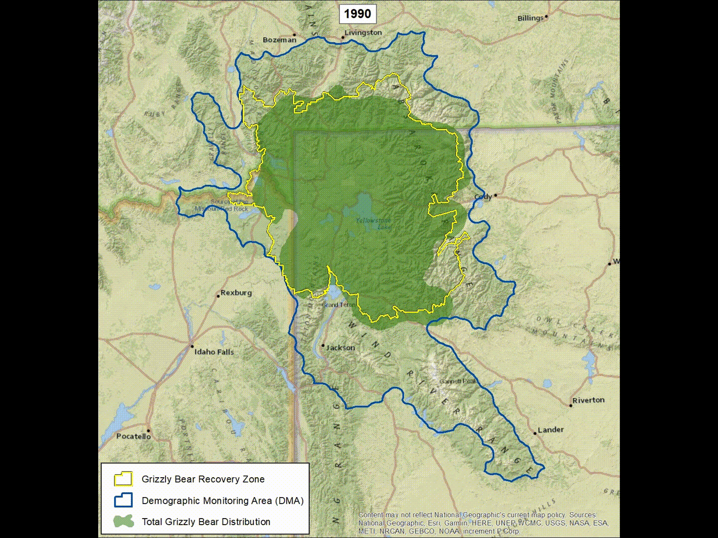
Image: Grizzly bear range expansion in Greater Yellowstone Ecosystem 1990–2018 – animated map
Description: Sequential estimates of occupied ranges for grizzly bears in the Greater Yellowstone Ecosystem during 1990–2018. Range extents are based on methods described in Bjornlie et al. (2014). Verified grizzly bear locations from a variety of sources, including VHF and GPS telemetry locations, sightings, mortalities, and human-bear conflicts for consecutive 10-year period were compiled and mapped onto a 3-km by 3-km grid. Zonal analysis and ordinary kriging was then applied to develop a predicted surface of occupied range. The procedure was applied to subsequent years by moving up the 15-year time period in 1-year increments (i.e., the frame labeled 1990 used location data obtained during 1976‒1990, the frame labeled 1991 used data obtained during 1977‒1991, etc. through 2018). (Animation by D. Bjornlie, Wyoming Game and Fish Department)
Title: Grizzly bear range expansion in Greater Yellowstone Ecosystem 1990–2018 – animated map
Credit: https://www.usgs.gov/media/images/animated-image-showing-grizzly-bear-range-expansion-gye-1990-2018
Author: United States Geological Survey
Usage Terms: Public domain
License: Public domain
Attribution Required?: No
Image usage
The following page links to this image:
