
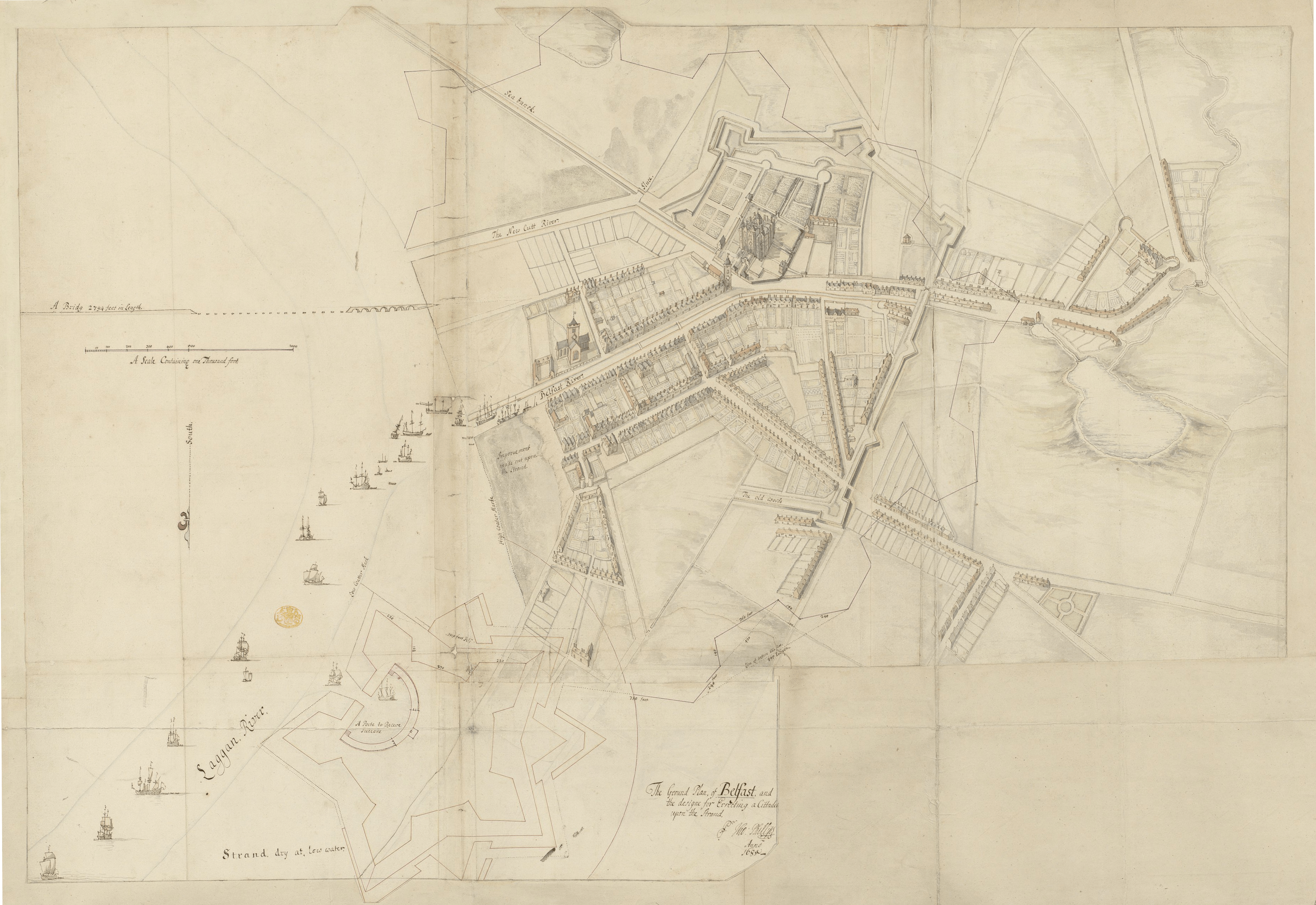
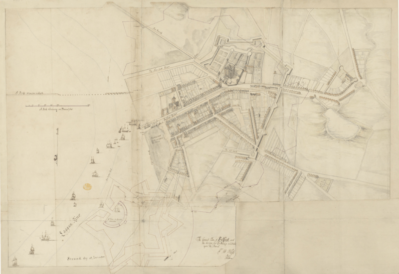
Image: Ground Plan of Belfast (1685)
Description: A pen and ink sketch of Belfast, prepared as part of Thomas Phillips' survey of Irish towns and fortifications. The town's existing ramparts are overlaid by a much grander scheme of Phillips' own devisal, with a plan for a citadel to the north. Landmarks include Belfast Castle and the Corporation Church, and the unfinished Long Bridge. The River Farset runs through the High Street and the Blackstaff flows through what would now be the eastern side of the city centre, meeting the Lagan at the "new cutt".
Title: Ground Plan of Belfast (1685)
Credit: The British Library King's Topographical Collection
Author: Thomas Phillips (d. 1693)
Usage Terms: Public domain
License: Public domain
Attribution Required?: No
Image usage
The following 2 pages link to this image:

.png)