
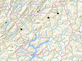
Image: HUC 031300010701 - Yellow Creek-Chestatee Riverf

Size of this JPG preview of this TIF file: 800 × 595 pixels. Other resolution: 320 × 238 pixels.
Original image (950 × 706 pixels, file size: 1.5 MB, MIME type: image/tiff)
Description: Map shows Yellow Creek flowing from northeast, joining the Chestatee River arm of Lake Lanier in the southern part of the map.
Title: HUC 031300010701 - Yellow Creek-Chestatee River
Credit: http://viewer.nationalmap.gov/viewer/nhd.html?p=nhd&b=base1&q=031300010701&x=-9342725.540251598&y=4086790.350845975&l=12&v=
Author: USGS
Usage Terms: Public domain
License: Public domain
Attribution Required?: No
Image usage
The following 2 pages link to this image:

All content from Kiddle encyclopedia articles (including the article images and facts) can be freely used under Attribution-ShareAlike license, unless stated otherwise.