
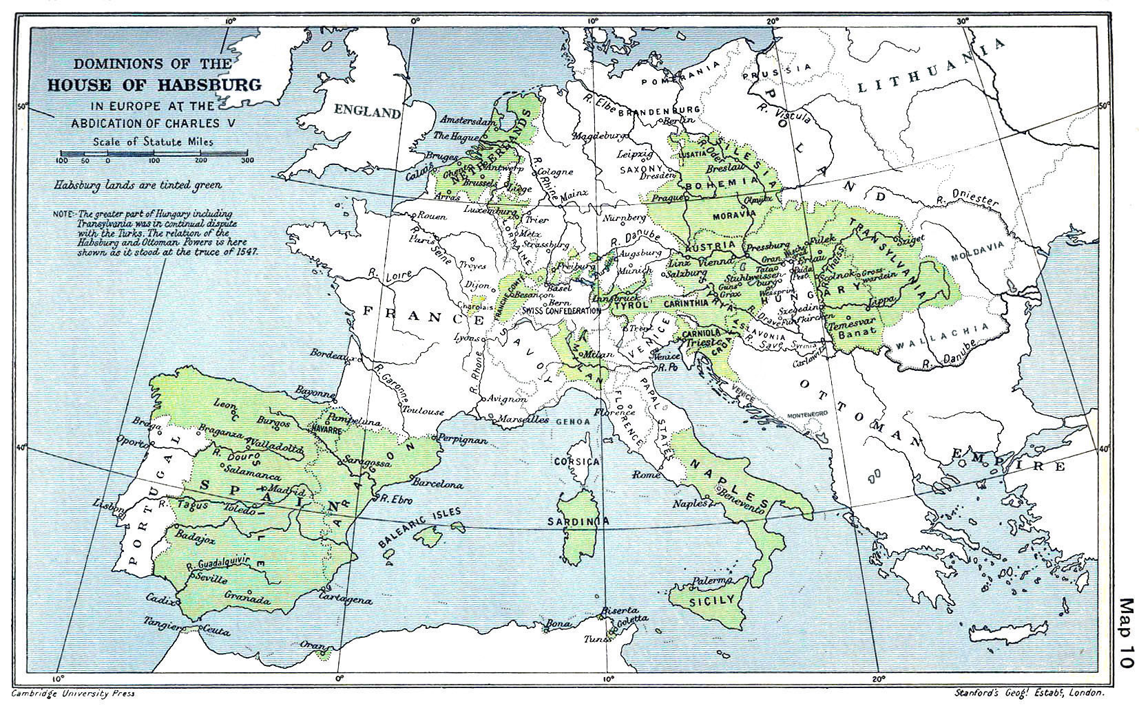
Image: Habsburg Map 1547
Size of this preview: 800 × 498 pixels. Other resolutions: 320 × 199 pixels | 1,654 × 1,029 pixels.
Original image (1,654 × 1,029 pixels, file size: 518 KB, MIME type: image/jpeg)
Description: A map of the dominion of the Habsburgs following the Battle of Mühlberg (1547)
Title: Habsburg Map 1547
Credit: The Cambridge Modern History Atlas, edited by Sir Adolphus William Ward, G.W. Prothero, Sir Stanley Mordaunt Leathes, and E.A. Benians. Cambridge University Press: London, 1912. Editors were Sir Adolphus William Ward (†1924), G.W. Prothero (†1922), and Sir Stanley Mordaunt Leathes (†1938). Individual authors of works making up the atlas are not identified, nor are the likely to be, after reasonable research.
Author: edited by Sir Adolphus William Ward, G.W. Prothero, Sir Stanley Mordaunt Leathes
Usage Terms: Public domain
License: Public domain
Attribution Required?: No
Image usage
The following 5 pages link to this image:

All content from Kiddle encyclopedia articles (including the article images and facts) can be freely used under Attribution-ShareAlike license, unless stated otherwise.