
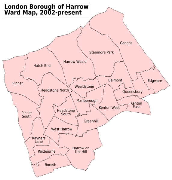
Image: Harrow London UK labelled ward map 2002

Size of this PNG preview of this SVG file: 572 × 599 pixels. Other resolution: 229 × 240 pixels.
Original image (SVG file, nominally 1,116 × 1,169 pixels, file size: 116 KB)
Description: A labelled map of the wards of the London Borough of Harrow which have been in use since 2 May 2002. Key: Boundaries District
Title: Harrow London UK labelled ward map 2002
Credit: This file was derived from Harrow London UK blank ward map.svg:
Author: Harrow London UK blank ward map.svg: Nilfanion, created using Ordnance Survey data derivative work: Doc77can
Usage Terms: Creative Commons Attribution-Share Alike 3.0
License: CC BY-SA 3.0
License Link: http://creativecommons.org/licenses/by-sa/3.0
Attribution Required?: Yes
Image usage
There are no pages that link to this image.

All content from Kiddle encyclopedia articles (including the article images and facts) can be freely used under Attribution-ShareAlike license, unless stated otherwise.