
Image: Hastings, New Zealand numbered suburbs map
Size of this preview: 783 × 599 pixels. Other resolutions: 314 × 240 pixels | 1,092 × 836 pixels.
Original image (1,092 × 836 pixels, file size: 117 KB, MIME type: image/png)
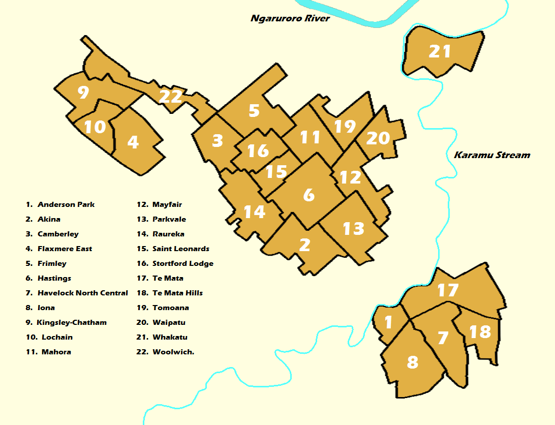
Description: Labelled map of the 22 Suburbs that make up Hastings City, New Zealand.
Title: Hastings, New Zealand numbered suburbs map
Credit: Own work
Author: CrashesToAshes
Usage Terms: Creative Commons Attribution-Share Alike 4.0
License: CC BY-SA 4.0
License Link: http://creativecommons.org/licenses/by-sa/4.0
Attribution Required?: Yes
Image usage
The following page links to this image:

All content from Kiddle encyclopedia articles (including the article images and facts) can be freely used under Attribution-ShareAlike license, unless stated otherwise.