
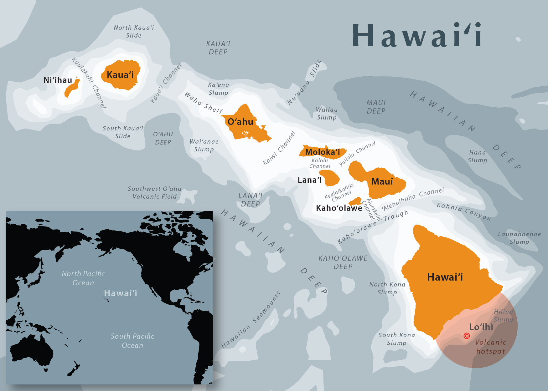
Image: Hawaii State Map
Size of this preview: 800 × 571 pixels. Other resolutions: 320 × 229 pixels | 1,750 × 1,250 pixels.
Original image (1,750 × 1,250 pixels, file size: 567 KB, MIME type: image/jpeg)
Description: Map of the main islands of Hawaii. UTM Zone 4N. Data sources: Natural Earth, Hawaii State GIS Program, USGS map "Hawaii's Volcanoes Revealed".
Title: Hawaii State Map
Credit: Own work
Author: Mapbliss
Usage Terms: Creative Commons Attribution-Share Alike 4.0
License: CC BY-SA 4.0
License Link: http://creativecommons.org/licenses/by-sa/4.0
Attribution Required?: Yes
Image usage
The following page links to this image:

All content from Kiddle encyclopedia articles (including the article images and facts) can be freely used under Attribution-ShareAlike license, unless stated otherwise.