
Image: Henderson's Mill Map 1864
No higher resolution available.
Henderson's_Mill_Map_1864.JPG (783 × 591 pixels, file size: 140 KB, MIME type: image/jpeg)
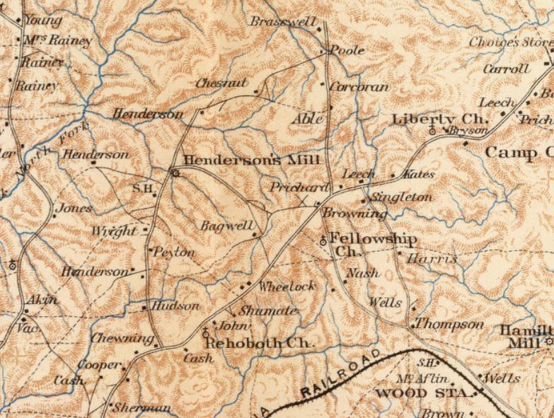
Description: Portion of a map from, Atlas to Accompany the Official Records of the Union and Confederate Armies. 1861-1865 including Henderson's Mill and surrounding area in DeKalb County, Georgia.
Title: Henderson's Mill Map 1864
Credit: Atlas to Accompany the Offical Records of the Union and Confederate Armies. 1861-1865. Plate LX. United States War Department 1895.
Author: Edward Ruger
Usage Terms: Public domain
License: Public domain
Attribution Required?: No
Image usage
The following page links to this image:

All content from Kiddle encyclopedia articles (including the article images and facts) can be freely used under Attribution-ShareAlike license, unless stated otherwise.