
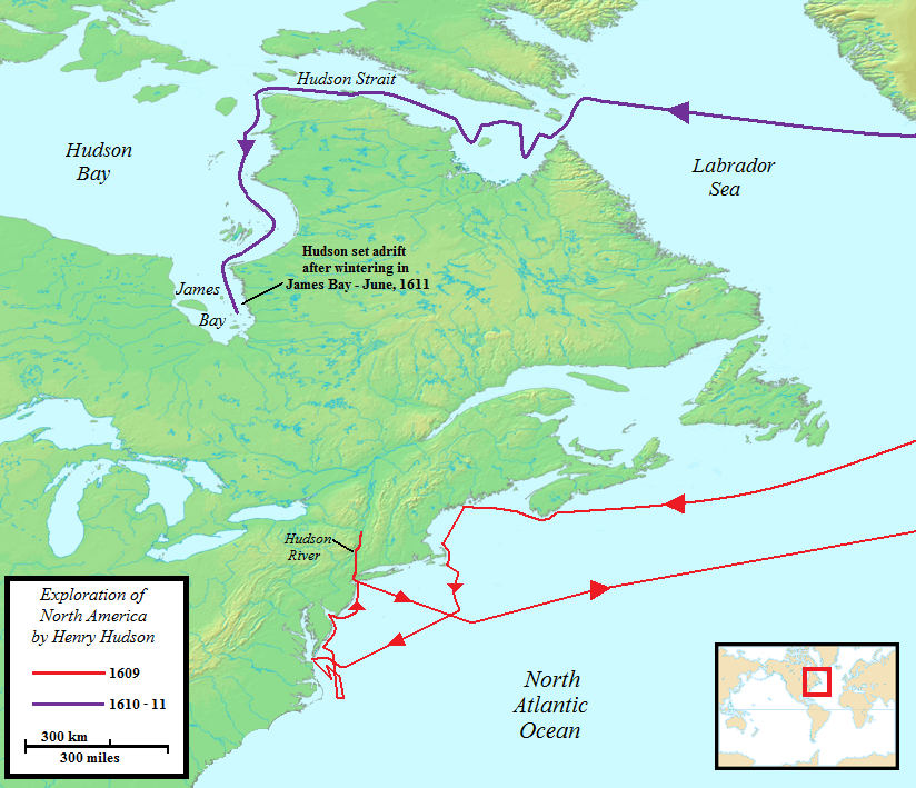
Image: Henry Hudson Map 26
Size of this preview: 697 × 600 pixels. Other resolutions: 279 × 240 pixels | 824 × 709 pixels.
Original image (824 × 709 pixels, file size: 499 KB, MIME type: image/png)
Description: Map of the two North American voyages of Henry Hudson. Route of first voyages shown in red, second in purple.
Title: Henry Hudson Map 26
Credit: Base map used: http://commons.wikimedia.org/wiki/File:Topographic30deg_N30W60.png, uploaded by User:Koba-chan. Rest of the work was that of the uploader.
Author: Jon Platek
Usage Terms: Creative Commons Attribution-Share Alike 3.0
License: CC BY-SA 3.0
License Link: http://creativecommons.org/licenses/by-sa/3.0
Attribution Required?: Yes
Image usage
The following 2 pages link to this image:

All content from Kiddle encyclopedia articles (including the article images and facts) can be freely used under Attribution-ShareAlike license, unless stated otherwise.