
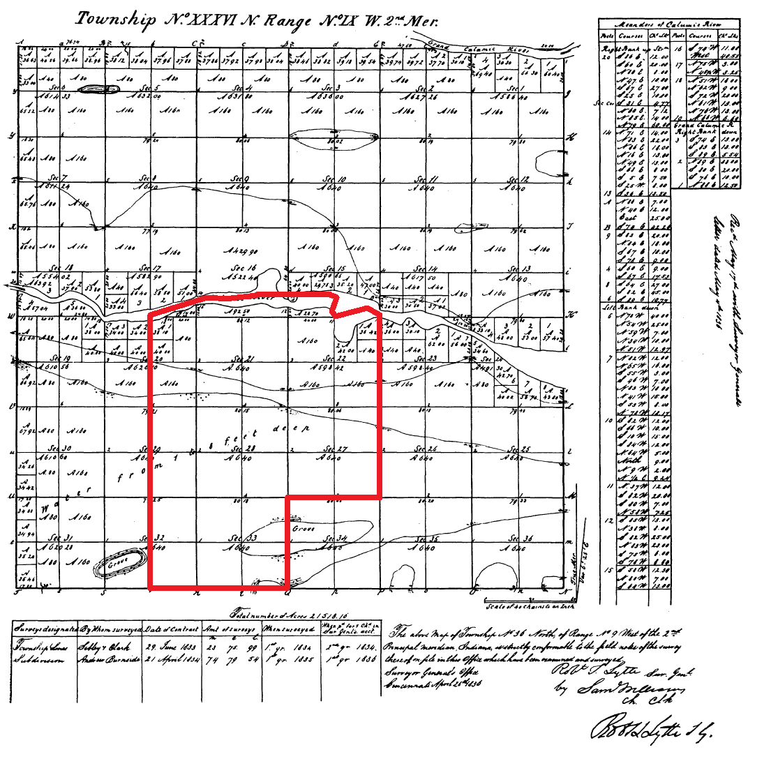
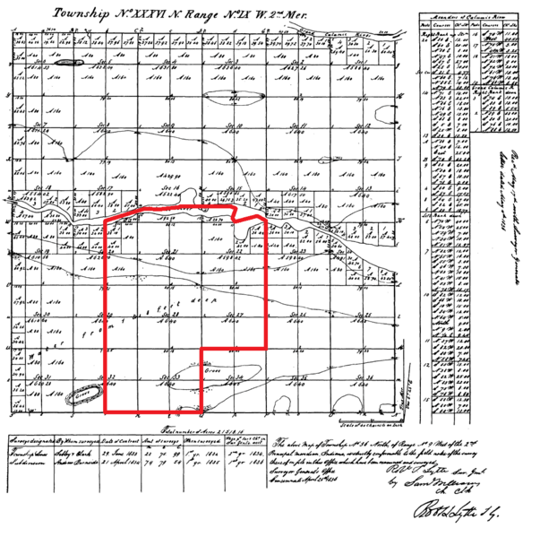
Image: Highland, Lake County, Indiana 1836
Size of this preview: 603 × 599 pixels. Other resolutions: 242 × 240 pixels | 1,105 × 1,098 pixels.
Original image (1,105 × 1,098 pixels, file size: 291 KB, MIME type: image/png)
Description: An 1836 government survey plat of Indiana Survey Township 36N, Range 9W, 2nd Principal Meridian, with the modern borders of Highland, IN outlined in red.
Title: Highland, Lake County, Indiana 1836
Credit: Surveyor-General’s Office of Indiana
Author: Surveyor-General’s Office of Indiana
Usage Terms: Public domain
License: Public domain
Attribution Required?: No
Image usage
The following page links to this image:

All content from Kiddle encyclopedia articles (including the article images and facts) can be freely used under Attribution-ShareAlike license, unless stated otherwise.