
Image: Highway 84, the Dumbarton Bridge, Palo Alto, Fremont 84 DSC 0456 (14664665595)
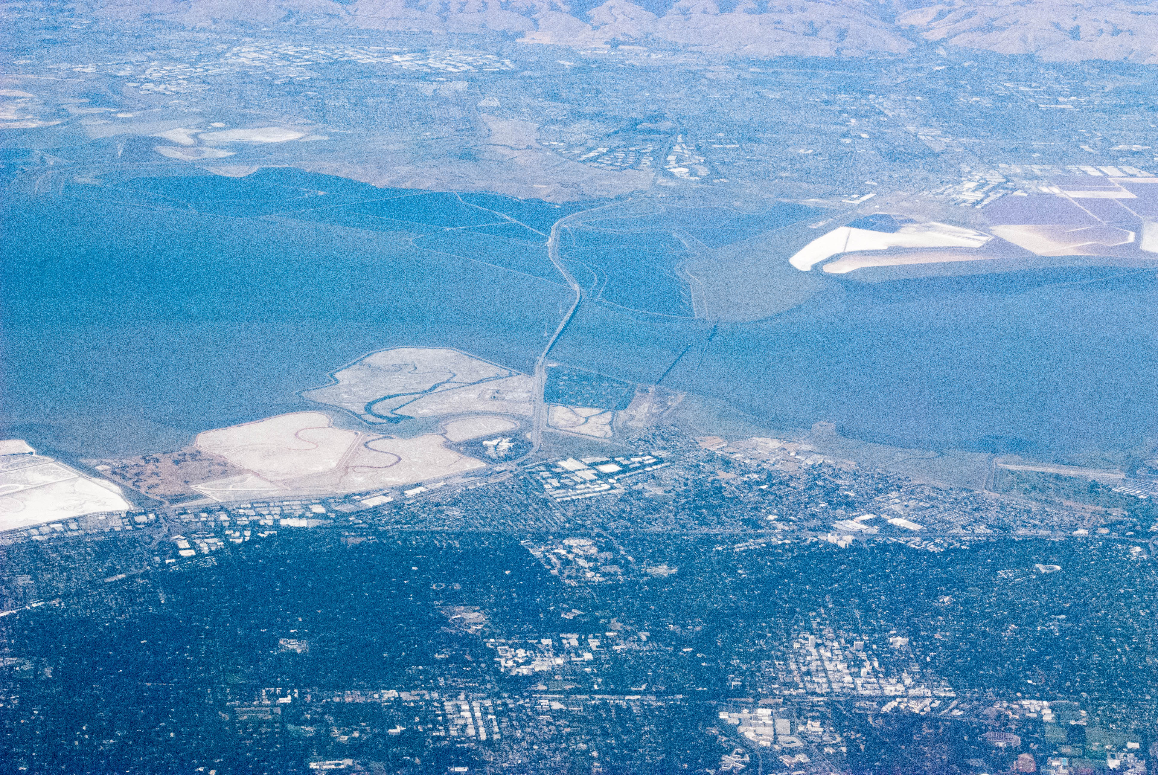
Description: Also the Cargill salt flats, former salt flats now returning to wetlands, Coyote Point park at the North East end of the bridge (top), and Facebook World Headquarters, in the curve between Bayfront Expressway and the approach to the Dumbarton bridge. Across that curve, heading to the lower right, we find the big business park off Willow Road. US 101 is the road running from left to right about 1/3 up from the bottom of the picture. El Camino Real, a surface street, runs parallel to 101, near the bottom of the picture. Note how green Palo Alto is, on the right, southern side of image, compared to East Palo Alto, a tougher, lower income enclave between 101 and the Bay. Menlo Park, to the left in this picture is even greener and more lush than Palo Alto. The right hand 1/5 of this image, below El Camino, is Leland Stanford Jr. University. You can see the stadium, fields, tree and scrub land-scaping of the campus. Directly to its left is the Stanford Shopping Center. Above, Across El Camino is downtown Palo Alto.
Title: Highway 84, the Dumbarton Bridge, Palo Alto, Fremont 84 DSC 0456 (14664665595)
Credit: Highway 84, the Dumbarton Bridge, Palo Alto, Fremont 84_DSC_0456
Author: Bill Abbott
Usage Terms: Creative Commons Attribution-Share Alike 2.0
License: CC BY-SA 2.0
License Link: http://creativecommons.org/licenses/by-sa/2.0
Attribution Required?: Yes
Image usage
The following page links to this image:

.jpg)