
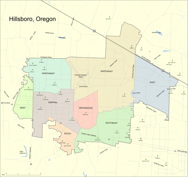
Image: Hillsboro Map

Size of this PNG preview of this SVG file: 637 × 599 pixels. Other resolution: 255 × 240 pixels.
Original image (SVG file, nominally 1,500 × 1,411 pixels, file size: 1.12 MB)
Description: Map of Hillsboro, Oregon.
Title: Hillsboro Map
Credit: self-made, based on this municipal map. Note added by User:Finetooth on 24 March 2009: The map is hosted at [1]. The underlying GIS map, created at a scale of 1 inch = 800 feet, is updated monthly, according to the source, the City of Hillsboro. A disclaimer by the source says, "While care has been taken to insure accuracy of the information, the City assumes no responsibility or liability of any errors or omissions in this information."
Author: Jeff Dahl
Usage Terms: GNU Free Documentation License
License: GFDL
License Link: http://www.gnu.org/copyleft/fdl.html
Attribution Required?: Yes
Image usage
There are no pages that link to this image.

All content from Kiddle encyclopedia articles (including the article images and facts) can be freely used under Attribution-ShareAlike license, unless stated otherwise.